MyTopo
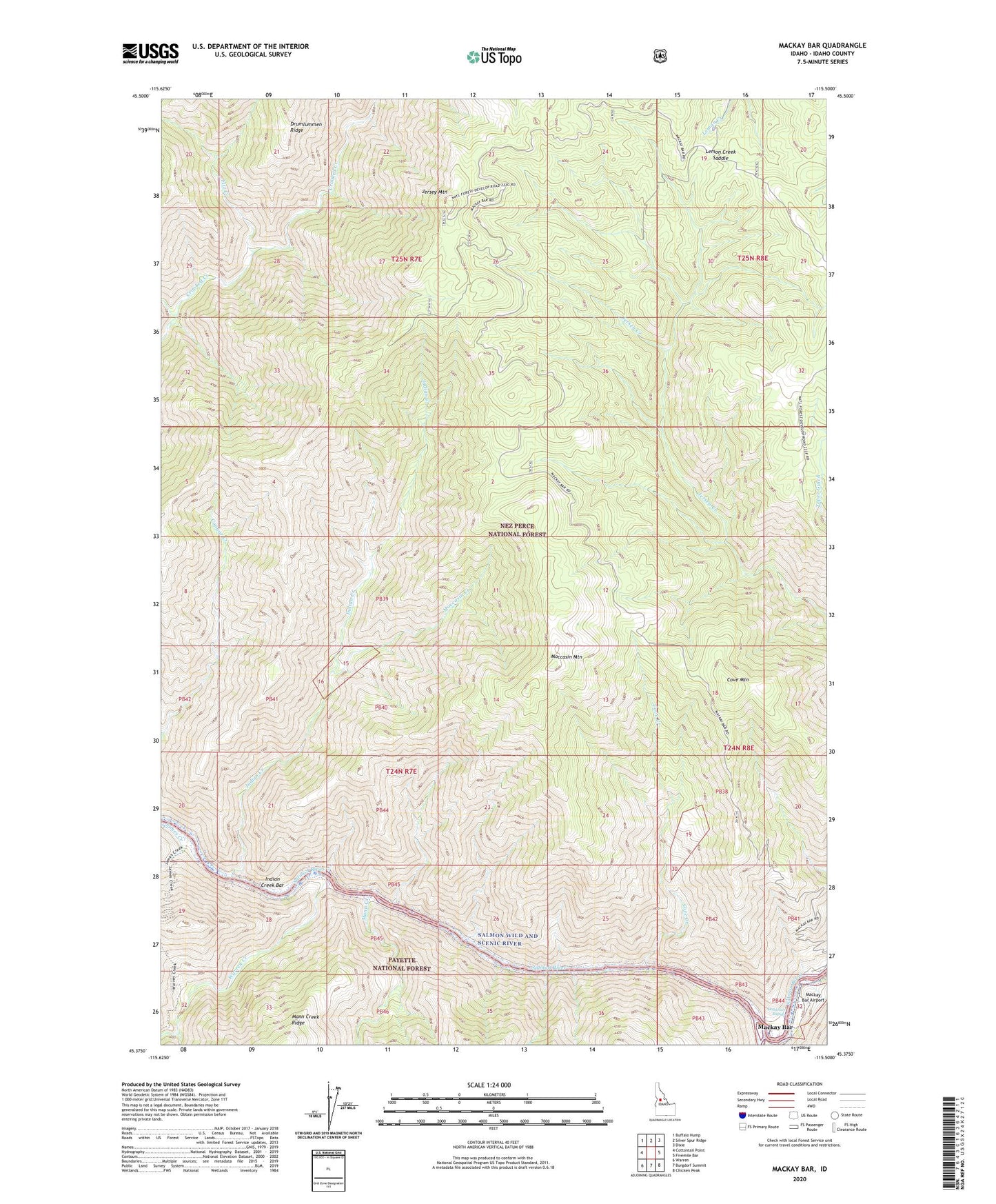
Mackay Bar Idaho US Topo Map
Couldn't load pickup availability
Also explore the Mackay Bar Forest Service Topo of this same quad for updated USFS data
2024 topographic map quadrangle Mackay Bar in the state of Idaho. Scale: 1:24000. Based on the newly updated USGS 7.5' US Topo map series, this map is in the following counties: Idaho. The map contains contour data, water features, and other items you are used to seeing on USGS maps, but also has updated roads and other features. This is the next generation of topographic maps. Printed on high-quality waterproof paper with UV fade-resistant inks.
Quads adjacent to this one:
West: Cottontail Point
Northwest: Buffalo Hump
North: Silver Spur Ridge
Northeast: Dixie
East: Fivemile Bar
Southeast: Chicken Peak
South: Burgdorf Summit
Southwest: Warren
This map covers the same area as the classic USGS quad with code o45115d5.
Contains the following named places: Cove Creek, Cove Mountain, Cove Ranch, Deadman Rapids, Fitz Creek, Indian Creek, Indian Creek Bar, Indian Creek Ranch, James Creek, James Ranch, Jersey Mountain, Lemon Creek Saddle, Mackay Bar, Mackay Bar Airport, Mackay Creek, Mann Creek, Moccasin Creek, Moccasin Mountain, Richardson Creek, Romine Ranch, South Fork Salmon River, War Eagle Mine, Warren Creek, West Fork Crooked Creek