MyTopo
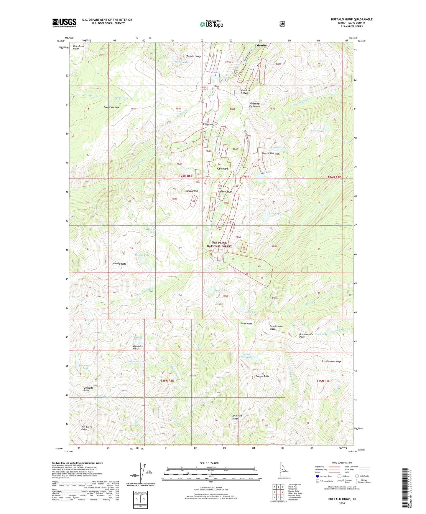
Buffalo Hump Idaho US Topo Map
Couldn't load pickup availability
Also explore the Buffalo Hump Forest Service Topo of this same quad for updated USFS data
2024 topographic map quadrangle Buffalo Hump in the state of Idaho. Scale: 1:24000. Based on the newly updated USGS 7.5' US Topo map series, this map is in the following counties: Idaho. The map contains contour data, water features, and other items you are used to seeing on USGS maps, but also has updated roads and other features. This is the next generation of topographic maps. Printed on high-quality waterproof paper with UV fade-resistant inks.
Quads adjacent to this one:
West: Marble Butte
Northwest: Sourdough Peak
North: North Pole
Northeast: Orogrande
East: Silver Spur Ridge
Southeast: Mackay Bar
South: Cottontail Point
Southwest: Johnson Butte
This map covers the same area as the classic USGS quad with code o45115e6.
Contains the following named places: Arlington Ridge, Atlas Mill, Atlas Mine, Bear Lake, Big Buffalo Mine, Brandon Creek, Brandon Lakes, Buffalo Hump, Bull Creek Ridge, Butcher Creek, Calendar, Concord, Concord Hill, Concord Landing Strip, Crackerjack Mine, Crescent Lake, Deer Lake, Del Rio Mine, Drumlummen Point, Drumlummen Ridge, Fawn Lake, Frogtown, Grave Ajax Mine, Half Acre Lake, Horseshoe Lake, Hump Lake, Humptown, Hurst Lake, Jumbo Camp, Jumbo Mine, Lucky Lad Mine, Mineral Hill, Mirror Lake, Mother Lode Mine, Oregon Butte, Oregon Butte Lake, Quartzite Butte, Quartzite Lake, Quartzite Ridge, Round Lake, Ruby Lake, Saint Louis Mine, Scotts Bluff, Shining Butte, Shining Lake, Square Lake, Squaw Meadow, Tepee Flats, Vesuvius Mine