MyTopo
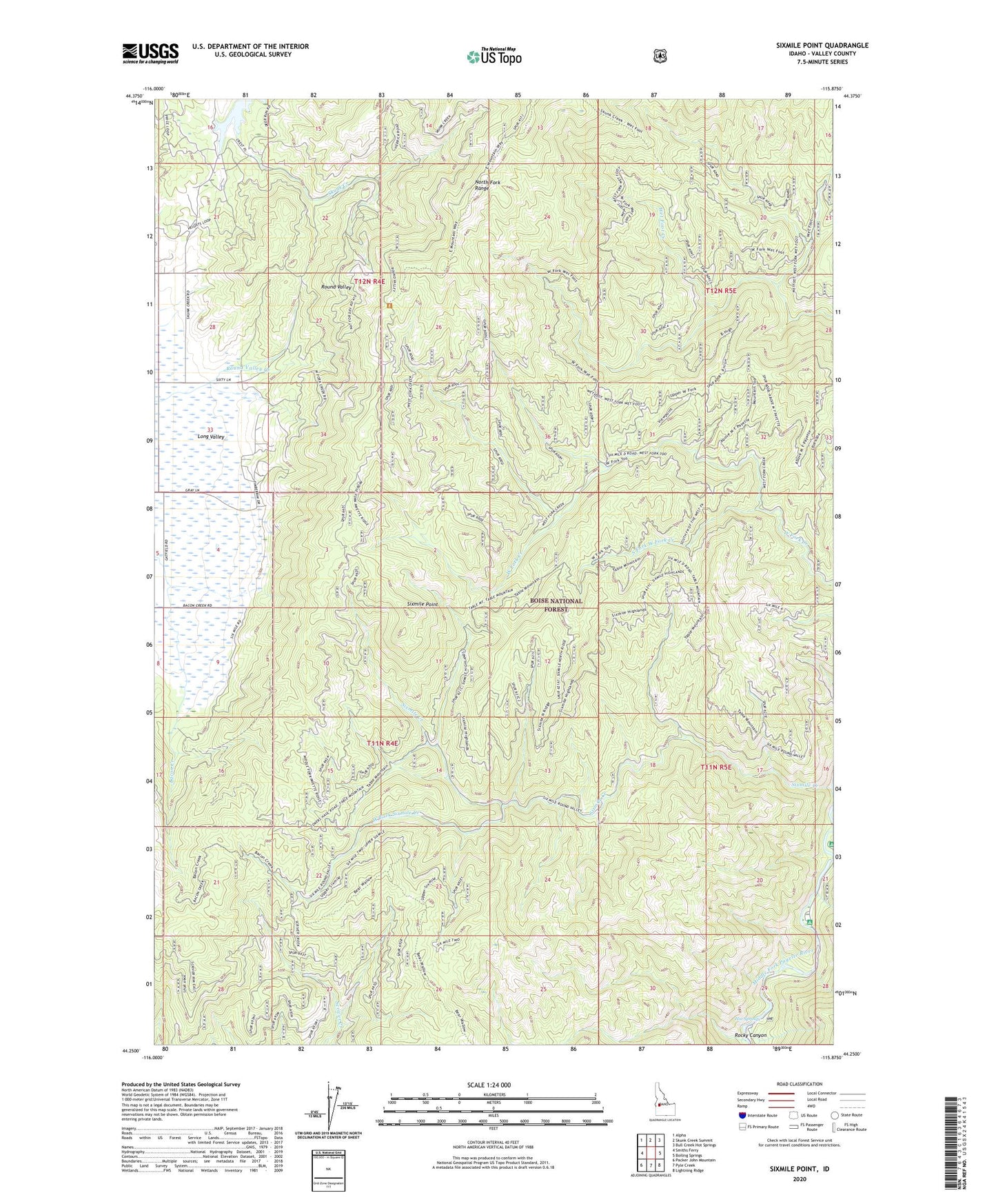
Sixmile Point Idaho US Topo Map
Couldn't load pickup availability
Also explore the Sixmile Point Forest Service Topo of this same quad for updated USFS data
2024 topographic map quadrangle Sixmile Point in the state of Idaho. Scale: 1:24000. Based on the newly updated USGS 7.5' US Topo map series, this map is in the following counties: Valley. The map contains contour data, water features, and other items you are used to seeing on USGS maps, but also has updated roads and other features. This is the next generation of topographic maps. Printed on high-quality waterproof paper with UV fade-resistant inks.
Quads adjacent to this one:
West: Smiths Ferry
Northwest: Alpha
North: Skunk Creek Summit
Northeast: Bull Creek Hot Springs
East: Boiling Springs
Southeast: Lightning Ridge
South: Pyle Creek
Southwest: Packer John Mountain
This map covers the same area as the classic USGS quad with code o44115c8.
Contains the following named places: Bear Wallow Trail, Herrick Reservoir, Herrick Reservoir Public Fishing Area, Hot Springs, Middle Fork Picnic Area, Rattlesnake Campground, Rattlesnake Creek, Rocky Canyon, Sixmile Creek, Sixmile Point, Sixmile Trail, South Fork West Fork Creek, Trail Creek, West Fork Sixmile Creek