MyTopo
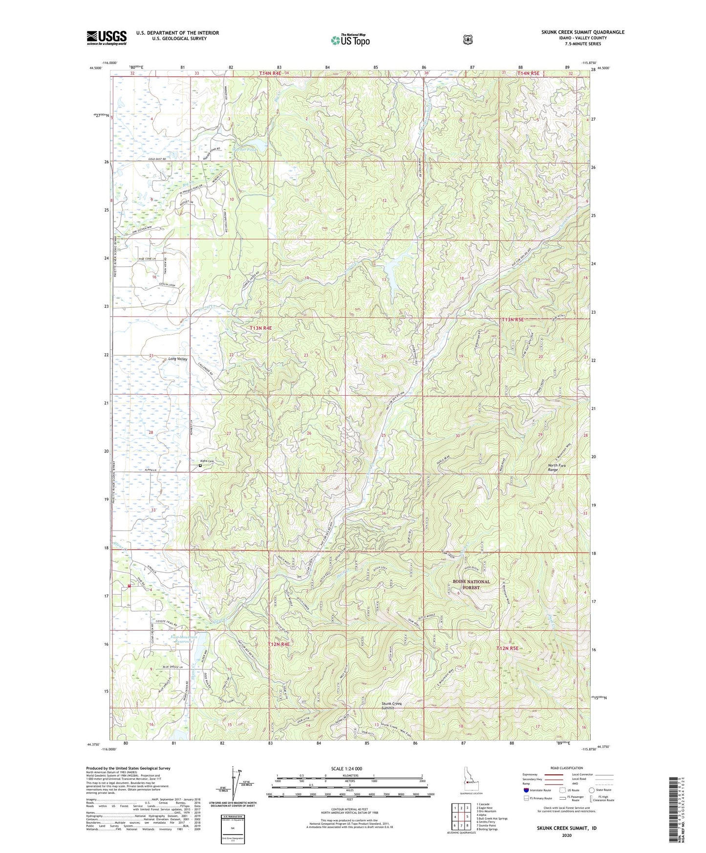
Skunk Creek Summit Idaho US Topo Map
Couldn't load pickup availability
Also explore the Skunk Creek Summit Forest Service Topo of this same quad for updated USFS data
2024 topographic map quadrangle Skunk Creek Summit in the state of Idaho. Scale: 1:24000. Based on the newly updated USGS 7.5' US Topo map series, this map is in the following counties: Valley. The map contains contour data, water features, and other items you are used to seeing on USGS maps, but also has updated roads and other features. This is the next generation of topographic maps. Printed on high-quality waterproof paper with UV fade-resistant inks.
Quads adjacent to this one:
West: Alpha
Northwest: Cascade
North: Eagle Nest
Northeast: Oro Mountain
East: Bull Creek Hot Springs
Southeast: Boiling Springs
South: Sixmile Point
Southwest: Smiths Ferry
This map covers the same area as the classic USGS quad with code o44115d8.
Contains the following named places: Alpha Cemetery, Alpha Grange, Cascade Division, Cascade Rural Fire Protection District Station 3, Corral Creek Dam, Corral Creek Reservoir, Ditch Creek, East Mountain Reservoir, Herrick Dam, Pitkin Dam, Skunk Creek, Skunk Creek Summit, Skunk Creek Trail, Warner Pond, Warren Diversion Dam