MyTopo
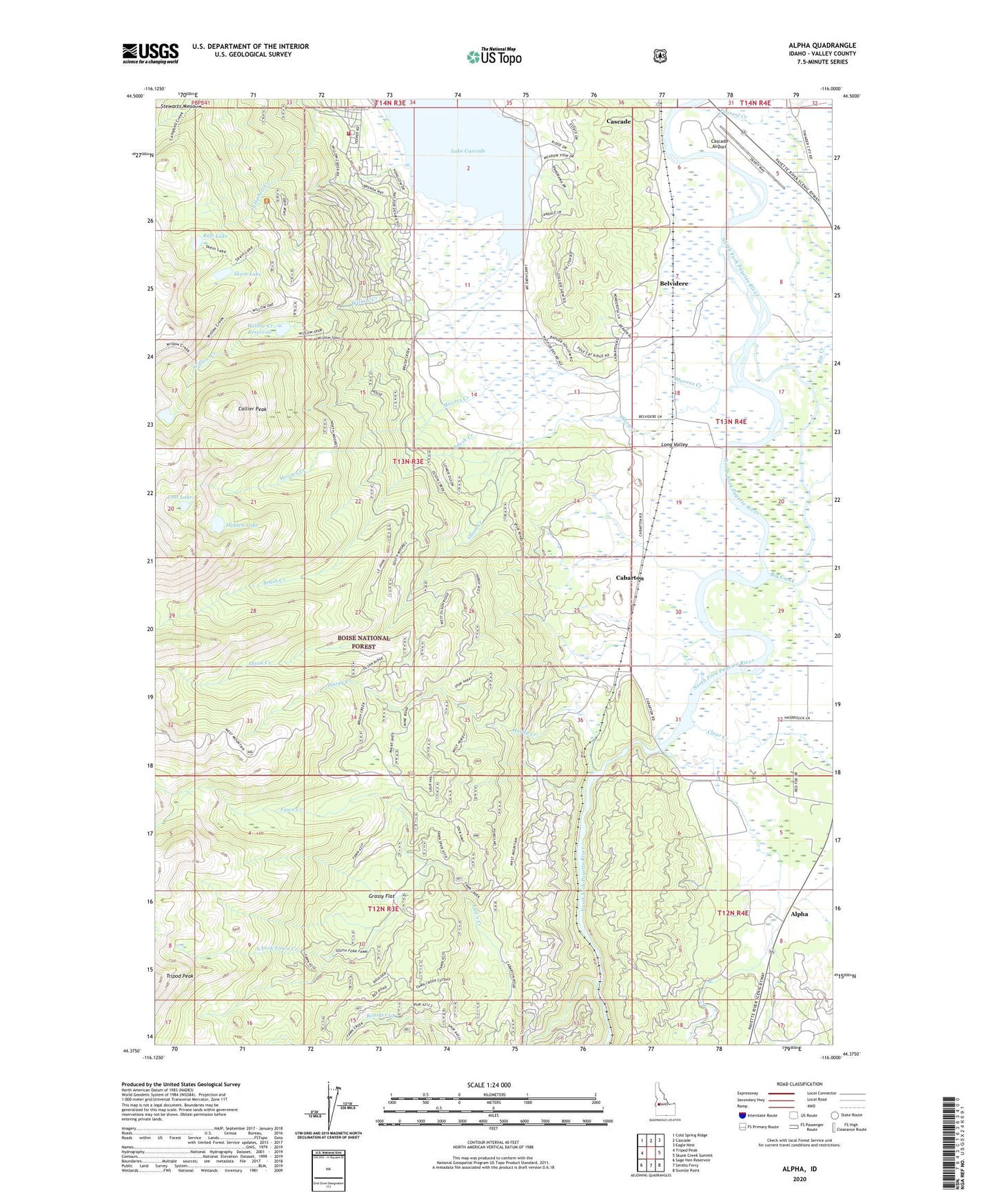
Alpha Idaho US Topo Map
Couldn't load pickup availability
Also explore the Alpha Forest Service Topo of this same quad for updated USFS data
2024 topographic map quadrangle Alpha in the state of Idaho. Scale: 1:24000. Based on the newly updated USGS 7.5' US Topo map series, this map is in the following counties: Valley. The map contains contour data, water features, and other items you are used to seeing on USGS maps, but also has updated roads and other features. This is the next generation of topographic maps. Printed on high-quality waterproof paper with UV fade-resistant inks.
Quads adjacent to this one:
West: Tripod Peak
Northwest: Cold Spring Ridge
North: Cascade
Northeast: Eagle Nest
East: Skunk Creek Summit
Southeast: Sixmile Point
South: Smiths Ferry
Southwest: Sage Hen Reservoir
This map covers the same area as the classic USGS quad with code o44116d1.
Contains the following named places: Alpha, Belvidere, Big Creek, Blue Lake Trail, Brush Creek, Cabarton, Cabarton Station, Campbell Creek Recreation Site, Campbell Creek Trail, Cascade Airport, Cascade Rural Fire Protection District Station 2, Clear Creek, Collier Peak, Corral Creek, Fawn Creek, Grassy Flat, Hidden Lake, Hurdy Creek, Lost Lake, Lower Alpha School, Moores Creek, Olson Creek, Pearsol Creek, Raft Lake, Skein Lake, Skein Lake Dam, South Fork Fawn Creek, Stewarts Meadow, Willow Creek, Willow Creek Reservoir, Willow Creek Trail