MyTopo
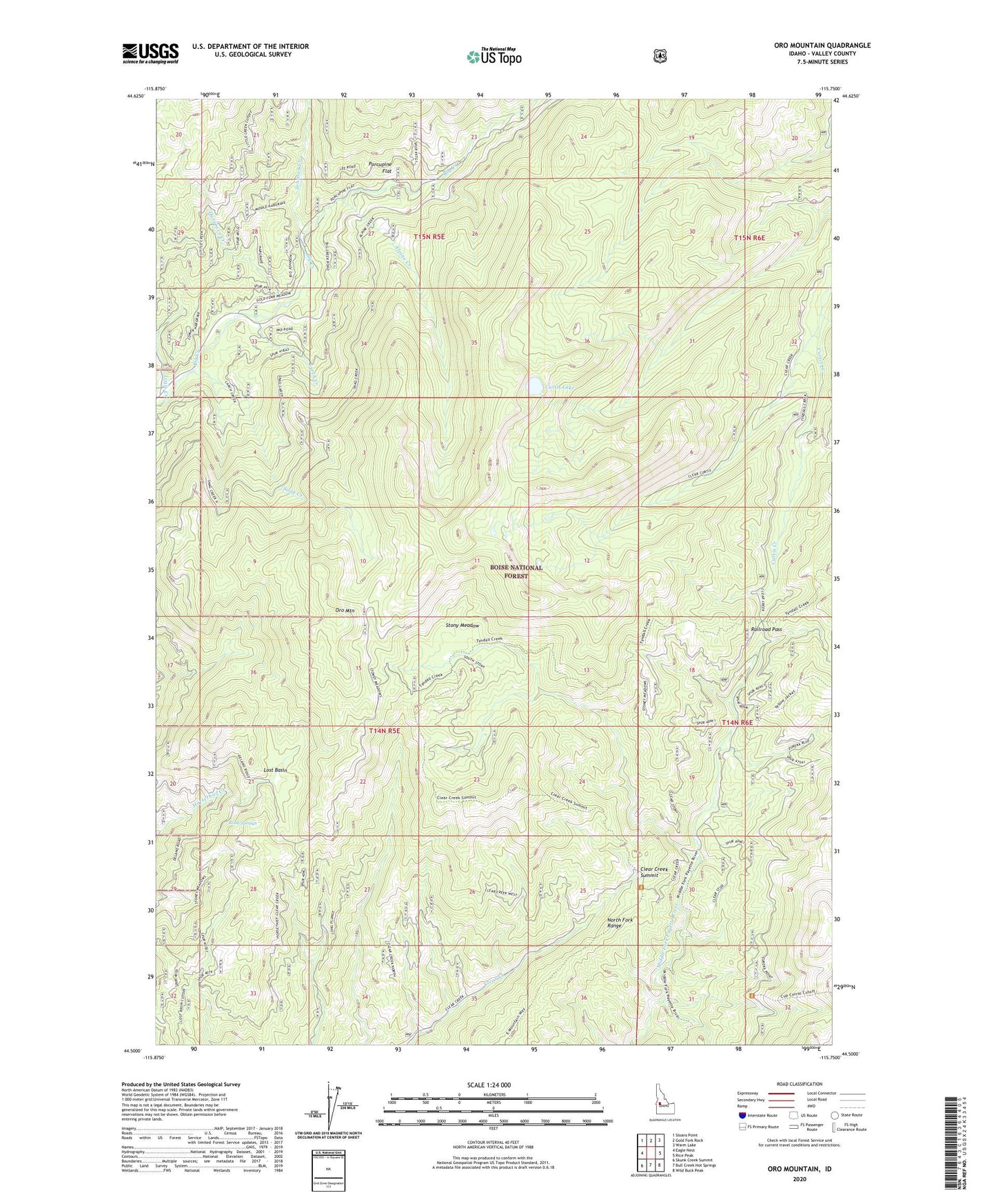
Oro Mountain Idaho US Topo Map
Couldn't load pickup availability
Also explore the Oro Mountain Forest Service Topo of this same quad for updated USFS data
2024 topographic map quadrangle Oro Mountain in the state of Idaho. Scale: 1:24000. Based on the newly updated USGS 7.5' US Topo map series, this map is in the following counties: Valley. The map contains contour data, water features, and other items you are used to seeing on USGS maps, but also has updated roads and other features. This is the next generation of topographic maps. Printed on high-quality waterproof paper with UV fade-resistant inks.
Quads adjacent to this one:
West: Eagle Nest
Northwest: Sloans Point
North: Gold Fork Rock
Northeast: Warm Lake
East: Rice Peak
Southeast: Wild Buck Peak
South: Bull Creek Hot Springs
Southwest: Skunk Creek Summit
This map covers the same area as the classic USGS quad with code o44115e7.
Contains the following named places: Alpine Creek, Clear Creek Summit, Curtis Lake, Curtis Way, Hargrave Creek, Johnson Creek, Larch Creek, Little Creek, Lost Basin, Oro Mountain, Porcupine Flat, Prince Albert Spring, Railroad Pass, Robb Springs, Snag Creek, Stony Meadow, Tyndall Creek Trail