MyTopo
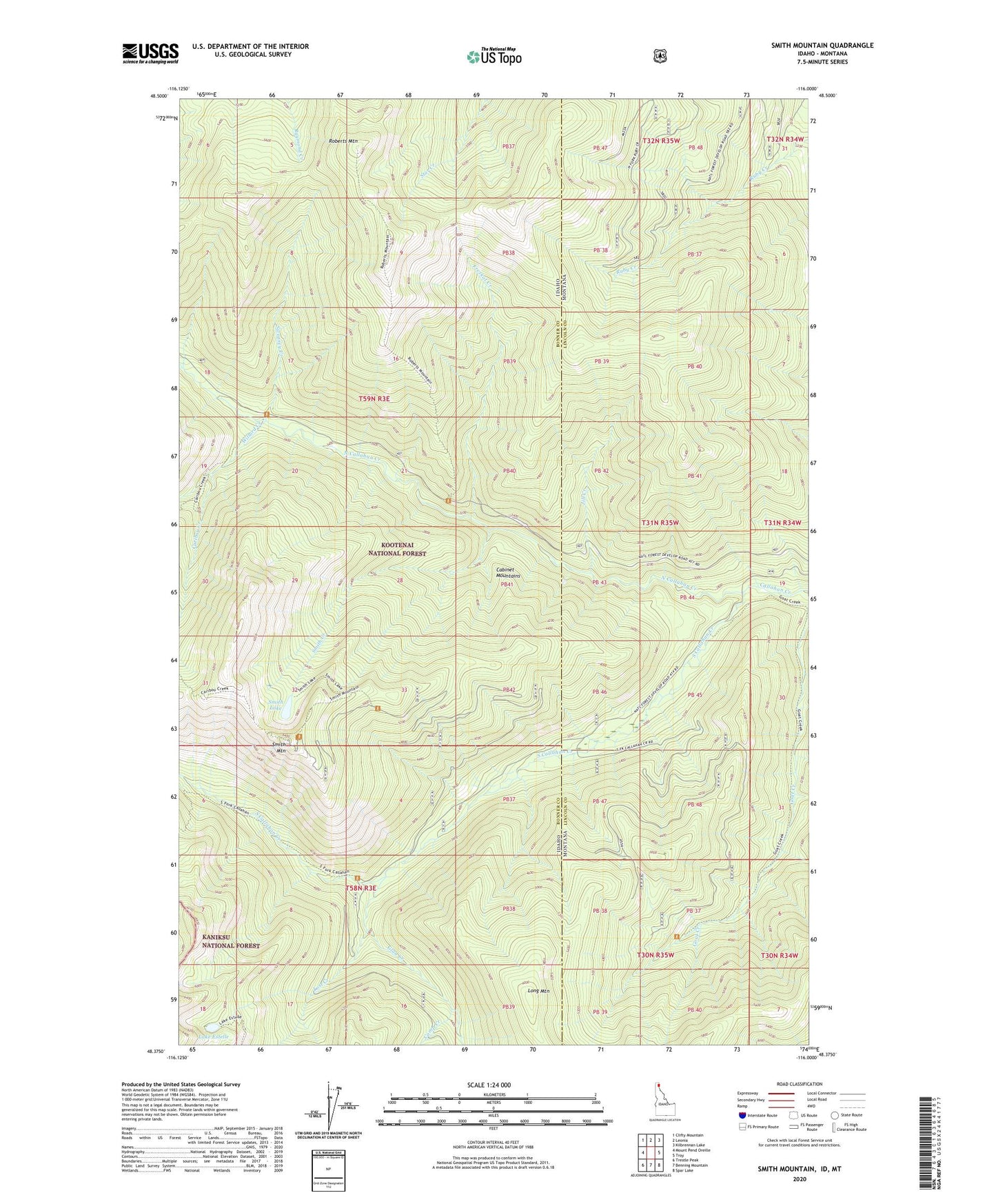
Smith Mountain Idaho US Topo Map
Couldn't load pickup availability
Also explore the Smith Mountain Forest Service Topo of this same quad for updated USFS data
2024 topographic map quadrangle Smith Mountain in the states of Idaho, Montana. Scale: 1:24000. Based on the newly updated USGS 7.5' US Topo map series, this map is in the following counties: Bonner, Lincoln. The map contains contour data, water features, and other items you are used to seeing on USGS maps, but also has updated roads and other features. This is the next generation of topographic maps. Printed on high-quality waterproof paper with UV fade-resistant inks.
Quads adjacent to this one:
West: Mount Pend Oreille
Northwest: Clifty Mountain
North: Leonia
Northeast: Kilbrennan Lake
East: Troy
Southeast: Spar Lake
South: Benning Mountain
Southwest: Trestle Peak
Contains the following named places: Camp Creek, Caribou Creek, Frezkat Creek, Glad Creek, Jill Creek, Lake Estelle, Long Mountain, Lost Creek, North Callahan Creek, Roberts Mountain, Smith Creek, Smith Lake, Smith Mountain, Smith Patrol Lookout, South Callahan Creek, Sweasey Creek, Willard Creek