MyTopo
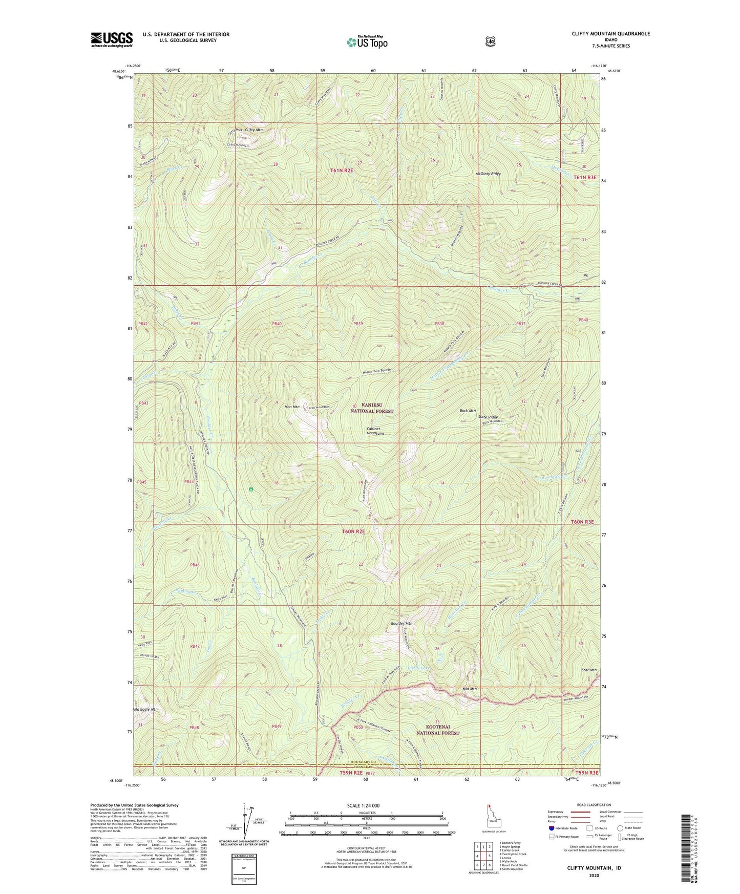
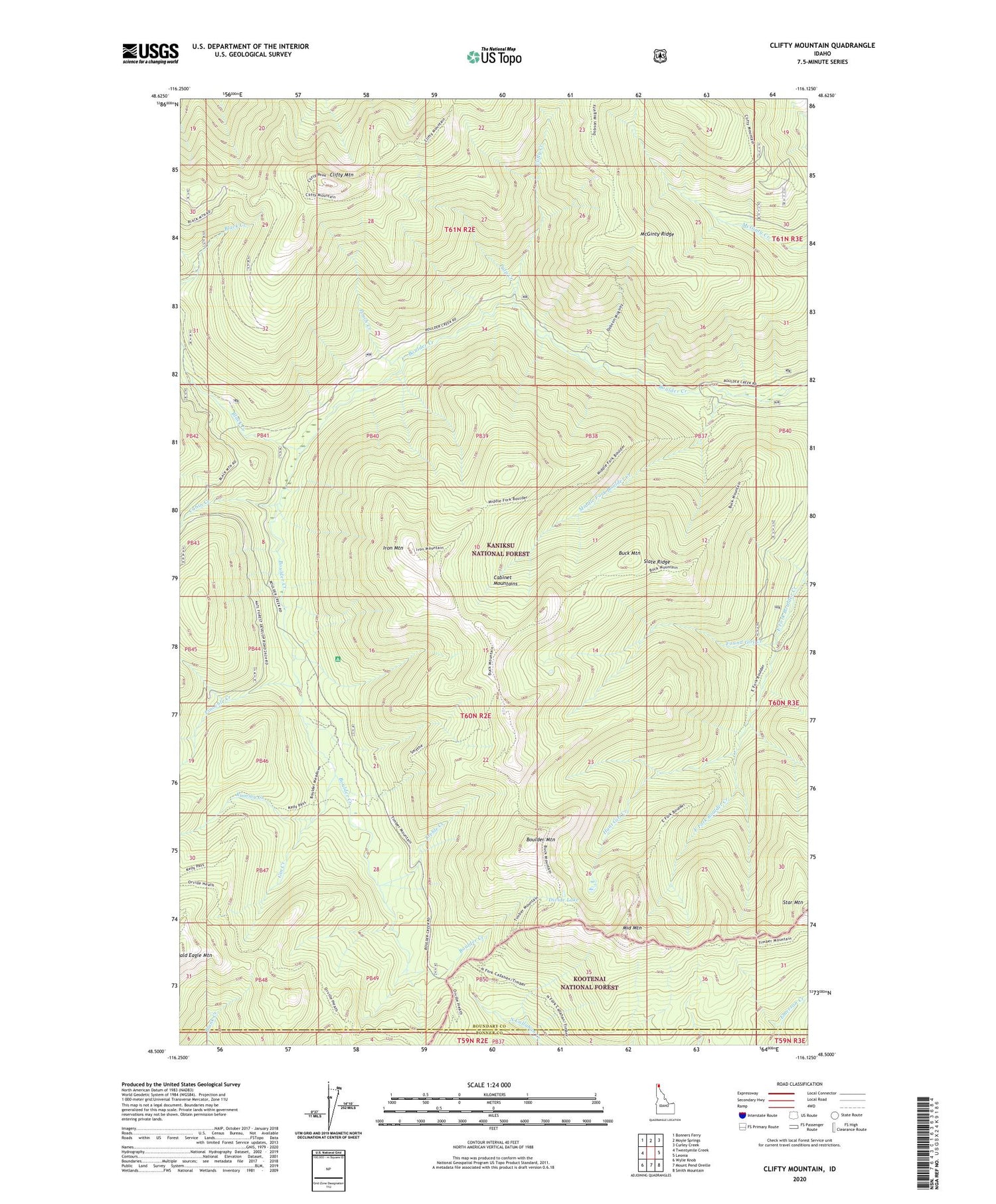
Clifty Mountain Idaho US Topo Map
Couldn't load pickup availability
Also explore the Clifty Mountain Forest Service Topo of this same quad for updated USFS data
2024 topographic map quadrangle Clifty Mountain in the state of Idaho. Scale: 1:24000. Based on the newly updated USGS 7.5' US Topo map series, this map is in the following counties: Boundary, Bonner. The map contains contour data, water features, and other items you are used to seeing on USGS maps, but also has updated roads and other features. This is the next generation of topographic maps. Printed on high-quality waterproof paper with UV fade-resistant inks.
Quads adjacent to this one:
West: Twentymile Creek
Northwest: Bonners Ferry
North: Moyie Springs
Northeast: Curley Creek
East: Leonia
Southeast: Smith Mountain
South: Mount Pend Oreille
Southwest: Wylie Knob
This map covers the same area as the classic USGS quad with code o48116e2.
Contains the following named places: Black Creek, Boulder Mine, Boulder Mountain, Buck Mountain, Buck Mountain Trail, Cabin Creek, Clifty Creek, Clifty Mountain, Divide Lake, Dobson Creek Trail, East Fork Boulder Creek Trail, Found Girl Creek, Gable Creek Trail, Gin Creek, Hunt Girl Creek, Hunt Girl Creek Research Natural Area, Iron Mountain, Iron Mountain Trail, Katka Peak Trail, Kelly Pass Trail, McGinty Ridge, Middle Fork Boulder Creek, Middle Mountain, Pinochle Creek, Poker Creek, Pouch Creek, Pulp Creek, Rummy Creek, Slate Ridge, Smythe Trail, Treble Creek