MyTopo
Kilbrennan Lake Montana US Topo Map
Couldn't load pickup availability
Also explore the Kilbrennan Lake Forest Service Topo of this same quad for updated USFS data
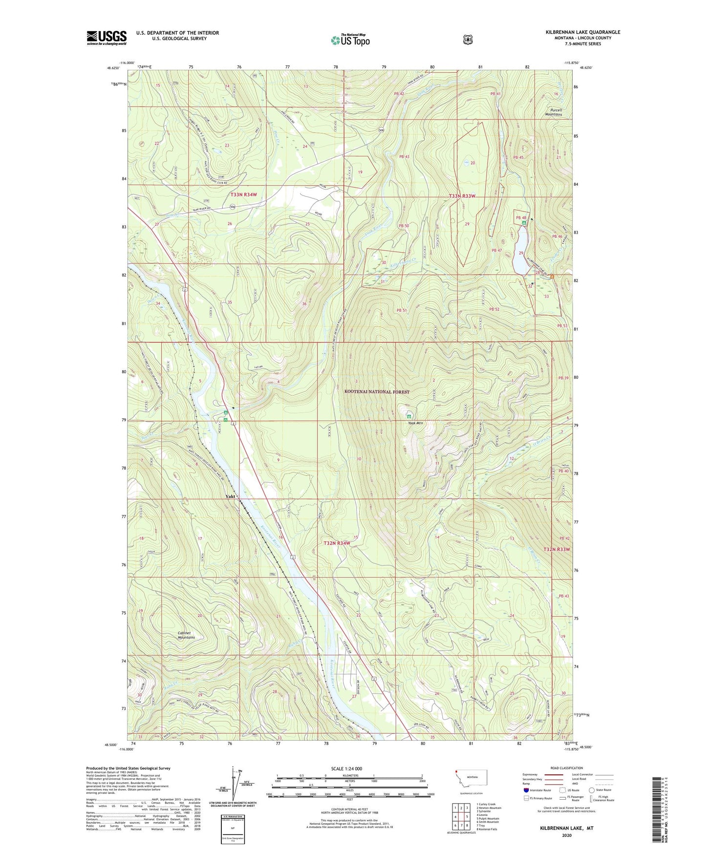
2024 topographic map quadrangle Kilbrennan Lake in the state of Montana. Scale: 1:24000. Based on the newly updated USGS 7.5' US Topo map series, this map is in the following counties: Lincoln. The map contains contour data, water features, and other items you are used to seeing on USGS maps, but also has updated roads and other features. This is the next generation of topographic maps. Printed on high-quality waterproof paper with UV fade-resistant inks.
Quads adjacent to this one:
West: Leonia
Northwest: Curley Creek
North: Newton Mountain
Northeast: Sylvanite
East: Pulpit Mountain
Southeast: Kootenai Falls
South: Troy
Southwest: Smith Mountain
This map covers the same area as the classic USGS quad with code o48115e8.
Contains the following named places: 32N34W09CDDA01 Well, 32N34W22CABD01 Well, 32N34W26CDCA01 Well, Brush Creek, Down Creek, Feeder Creek, Kilbrennan Creek, Kilbrennan Lake, Kilbrennan Lake Campground, Pine Creek, Star Creek, Yaak Campground, Yaak Mountain, Yaak River, Yaak River Campground, Yakt