MyTopo
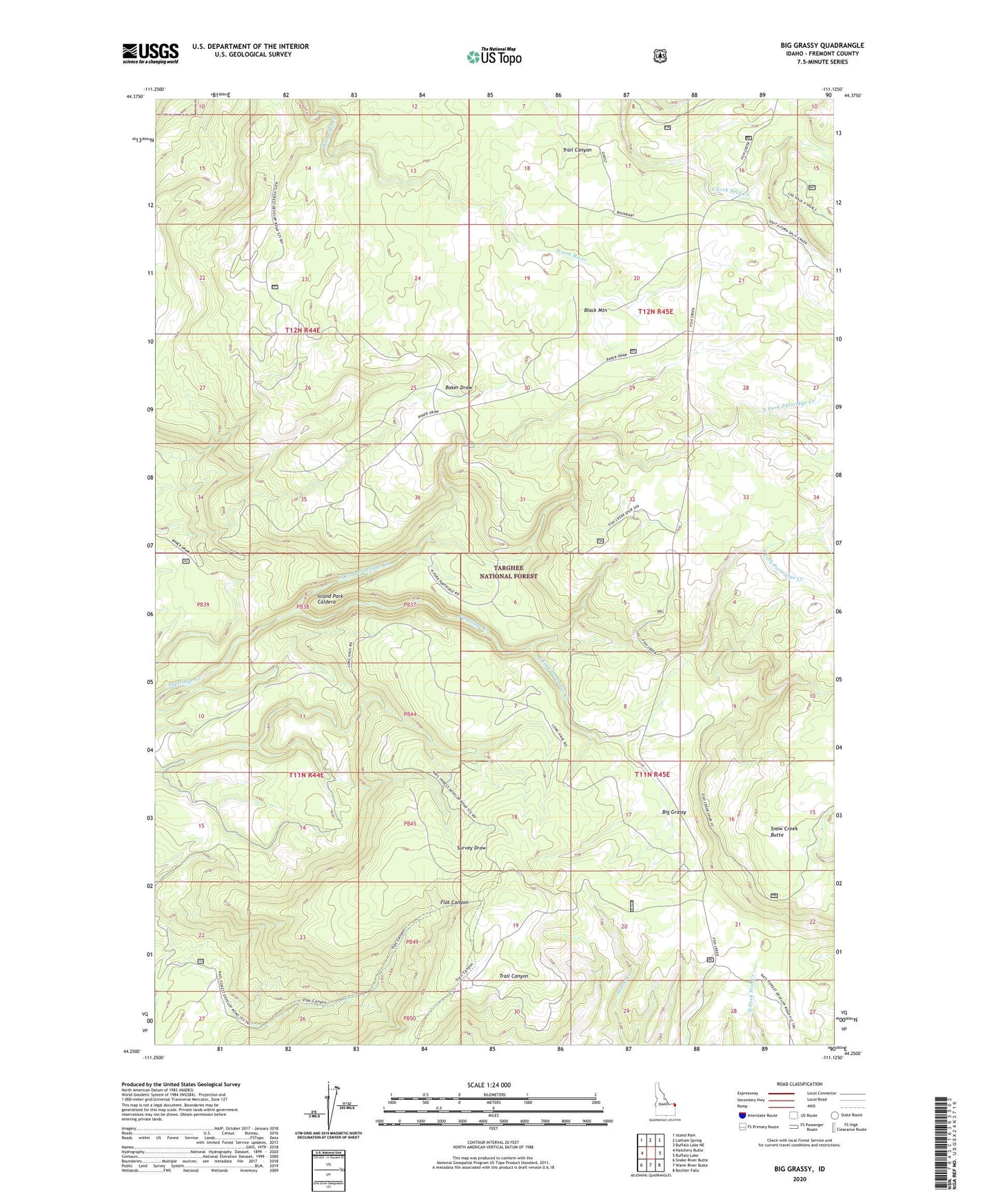
Big Grassy Idaho US Topo Map
Couldn't load pickup availability
Also explore the Big Grassy Forest Service Topo of this same quad for updated USFS data
2023 topographic map quadrangle Big Grassy in the state of Idaho. Scale: 1:24000. Based on the newly updated USGS 7.5' US Topo map series, this map is in the following counties: Fremont. The map contains contour data, water features, and other items you are used to seeing on USGS maps, but also has updated roads and other features. This is the next generation of topographic maps. Printed on high-quality waterproof paper with UV fade-resistant inks.
Quads adjacent to this one:
West: Hatchery Butte
Northwest: Island Park
North: Latham Spring
Northeast: Buffalo Lake NE
East: Buffalo Lake
Southeast: Bechler Falls
South: Warm River Butte
Southwest: Snake River Butte
This map covers the same area as the classic USGS quad with code o44111c2.
Contains the following named places: Big Grassy, Black Mountain, North Fork Partridge Creek, Snow Creek Butte, South Fork Partridge Creek