MyTopo
Spring Creek Reservoir Idaho US Topo Map
Couldn't load pickup availability
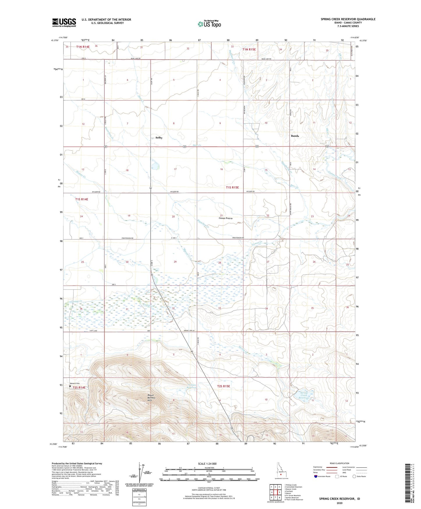
2023 topographic map quadrangle Spring Creek Reservoir in the state of Idaho. Scale: 1:24000. Based on the newly updated USGS 7.5' US Topo map series, this map is in the following counties: Camas. The map contains contour data, water features, and other items you are used to seeing on USGS maps, but also has updated roads and other features. This is the next generation of topographic maps. Printed on high-quality waterproof paper with UV fade-resistant inks.
Quads adjacent to this one:
West: Fairfield
Northwest: Phillips Creek
North: Cannonball Mountain
Northeast: Beaver Creek
East: Macon
Southeast: Thorn Creek Reservoir
South: McHan Reservoir
Southwest: Fir Grove Mountain
This map covers the same area as the classic USGS quad with code o43114c6.
Contains the following named places: Daugherty Creek, Deer Creek, Elk Creek, Elk Creek School, Knowlton Creek, Manard Cemetery, Manard School, Minear Creek, Neilsen Reservoir, Rands, Selby, Spring Creek, Spring Creek Dam, Spring Creek Reservoir, Springdale School