MyTopo
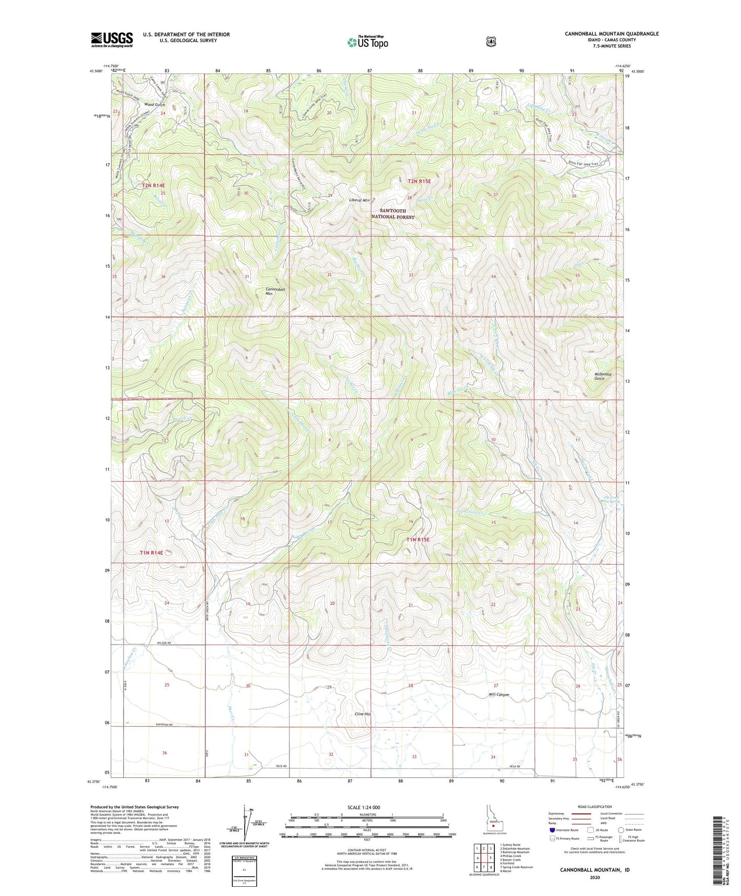
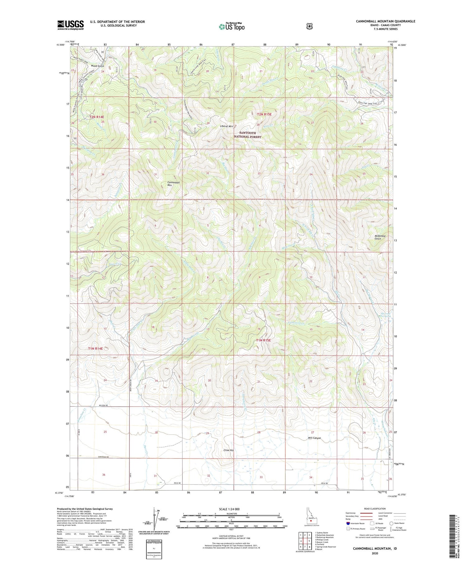
Cannonball Mountain Idaho US Topo Map
Couldn't load pickup availability
Also explore the Cannonball Mountain Forest Service Topo of this same quad for updated USFS data
2024 topographic map quadrangle Cannonball Mountain in the state of Idaho. Scale: 1:24000. Based on the newly updated USGS 7.5' US Topo map series, this map is in the following counties: Camas. The map contains contour data, water features, and other items you are used to seeing on USGS maps, but also has updated roads and other features. This is the next generation of topographic maps. Printed on high-quality waterproof paper with UV fade-resistant inks.
Quads adjacent to this one:
West: Phillips Creek
Northwest: Sydney Butte
North: Dollarhide Mountain
Northeast: Buttercup Mountain
East: Beaver Creek
Southeast: Macon
South: Spring Creek Reservoir
Southwest: Fairfield
This map covers the same area as the classic USGS quad with code o43114d6.
Contains the following named places: Big Deer Creek, Blowout Creek, Buttercup Creek, Cannonball Creek, Cannonball Mountain, Chicken Creek, Cline Hill, Cookstove Creek, East Camas Division, East Fork Elk Creek, Elk Creek Hot Spring, Hot Spring Creek, Liberal Mountain, Lightning Creek, Little Deer Creek, Mill Canyon, Sawmill Creek, West Fork Elk Creek, Wood Gulch