MyTopo
Stanley Idaho US Topo Map
Couldn't load pickup availability
Also explore the Stanley Forest Service Topo of this same quad for updated USFS data
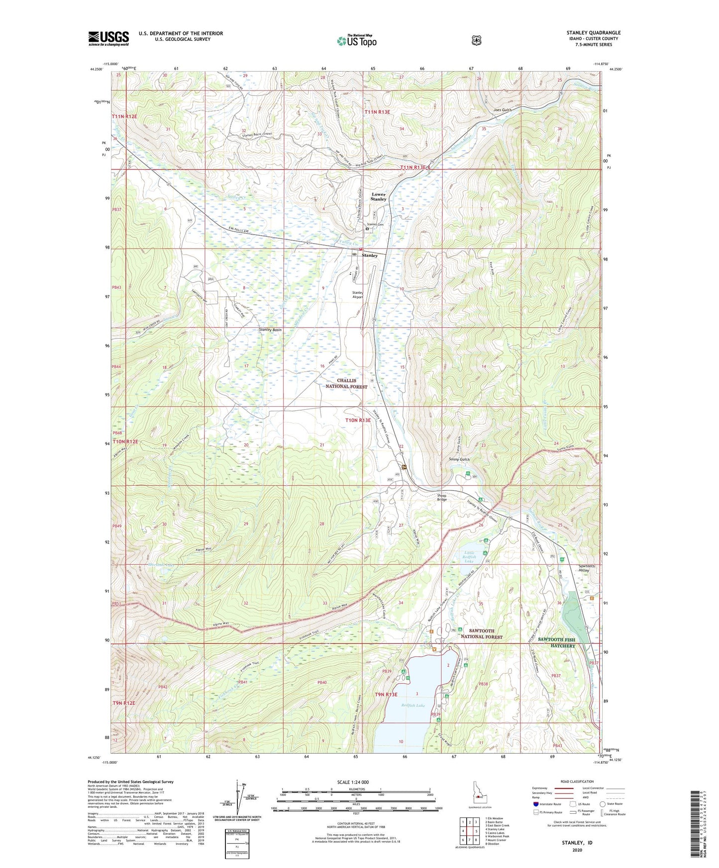
2024 topographic map quadrangle Stanley in the state of Idaho. Scale: 1:24000. Based on the newly updated USGS 7.5' US Topo map series, this map is in the following counties: Custer. The map contains contour data, water features, and other items you are used to seeing on USGS maps, but also has updated roads and other features. This is the next generation of topographic maps. Printed on high-quality waterproof paper with UV fade-resistant inks.
Quads adjacent to this one:
West: Stanley Lake
Northwest: Elk Meadow
North: Basin Butte
Northeast: East Basin Creek
East: Casino Lakes
Southeast: Obsidian
South: Mount Cramer
Southwest: Warbonnet Peak
This map covers the same area as the classic USGS quad with code o44114b8.
Contains the following named places: Boundary Creek, Buckhorn Roadside Rest, Chinook Bay Campground, City of Stanley, Cleveland Creek, Crooked Creek, Elkhorn Creek, Fishhook Creek, Four Aces Creek, Glacier View Campground, Goat Creek, Heyburn Mountain Campground, Iron Creek, Joes Gulch, Little Redfish Lake, Lower Stanley, Marshall Lake, Meadow Creek, Mountain View Campground, Nip and Tuck Creek, North Shore Picnic Ground, Point Campground, Redfish Lake Creek, Redfish Lake Lodge, Redfish Lake Visitors Center, Redfish Outlet Campground, Sandy Beach Boat Ramp, Sawtooth Fish Hatchery, Sawtooth Valley, Sawtooth Valley Rural Fire Department, Sheep Bridge, Sockeye Campground, Stanley, Stanley Airport, Stanley Basin, Stanley Cemetery, Stanley District Ranger Office, Stanley Elementary - Junior High School, Stanley Museum Recreation Site, Stanley Post Office, Sunny Gulch, Sunny Gulch Campground, Valley Creek, Valley Creek Ranger Station