MyTopo
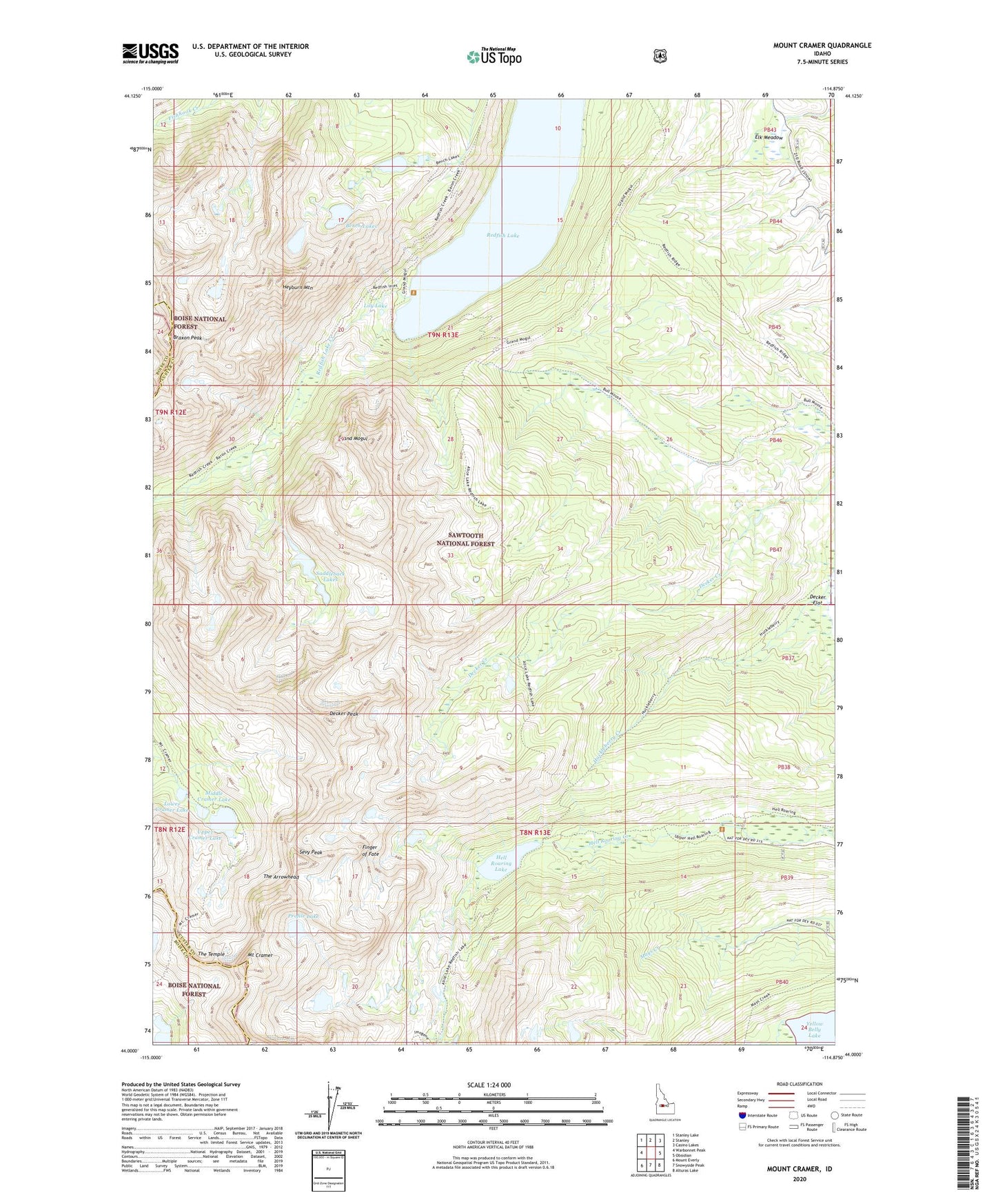
Mount Cramer Idaho US Topo Map
Couldn't load pickup availability
Also explore the Mount Cramer Forest Service Topo of this same quad for updated USFS data
2024 topographic map quadrangle Mount Cramer in the state of Idaho. Scale: 1:24000. Based on the newly updated USGS 7.5' US Topo map series, this map is in the following counties: Custer, Boise. The map contains contour data, water features, and other items you are used to seeing on USGS maps, but also has updated roads and other features. This is the next generation of topographic maps. Printed on high-quality waterproof paper with UV fade-resistant inks.
Quads adjacent to this one:
West: Warbonnet Peak
Northwest: Stanley Lake
North: Stanley
Northeast: Casino Lakes
East: Obsidian
Southeast: Alturas Lake
South: Snowyside Peak
Southwest: Mount Everly
This map covers the same area as the classic USGS quad with code o44114a8.
Contains the following named places: Bench Lakes, Braxon Peak, Bull Moose Trail, Decker Peak, Elk Meadow, Finger of Fate, Grand Mogul, Hell Roaring Lake, Heyburn Mountain, Hidden Lake, Lily Lake, Lower Cramer Lake, Middle Cramer Lake, Mount Cramer, Profile Lake, Redfish Inlet Transfer Camp, Redfish Lake, Saddleback Lakes, Sevy Peak, The Arrowhead, The Temple, Upper Cramer Lake, Yellow Belly Lake