MyTopo
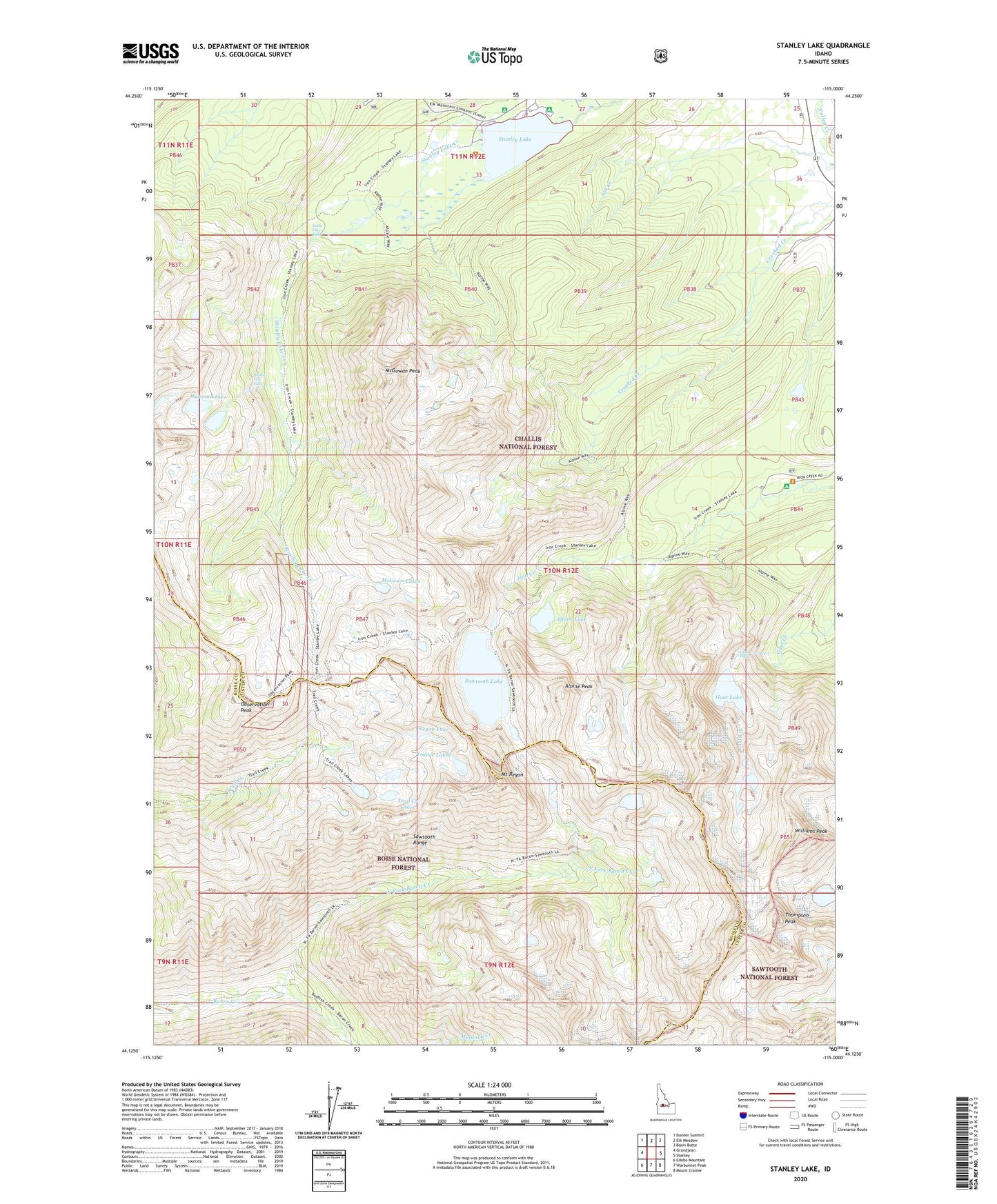
Stanley Lake Idaho US Topo Map
Couldn't load pickup availability
Also explore the Stanley Lake Forest Service Topo of this same quad for updated USFS data
2024 topographic map quadrangle Stanley Lake in the state of Idaho. Scale: 1:24000. Based on the newly updated USGS 7.5' US Topo map series, this map is in the following counties: Custer, Boise. The map contains contour data, water features, and other items you are used to seeing on USGS maps, but also has updated roads and other features. This is the next generation of topographic maps. Printed on high-quality waterproof paper with UV fade-resistant inks.
Quads adjacent to this one:
West: Grandjean
Northwest: Banner Summit
North: Elk Meadow
Northeast: Basin Butte
East: Stanley
Southeast: Mount Cramer
South: Warbonnet Peak
Southwest: Edaho Mountain
This map covers the same area as the classic USGS quad with code o44115b1.
Contains the following named places: Alpine Lake, Alpine Peak, Bridal Veil Falls, Goat Falls, Goat Lake, Greenback Mine, Hanson Lakes, Inlet Campground, Iron Creek Campground, Job Creek, Lady Face Falls, Lake View Campground, McGowan Peak, McGown Lakes, Mount Regan, North Fork Baron Creek, Observation Peak, Regan Lake, Sawtooth Lake, Sawtooth Range, Stanley Lake, Stanley Lake Campground, Stanley Lake Fish Barrier Dam, Thompson Peak, Trail Creek Lakes, Trailer Lakes, Williams Peak