MyTopo
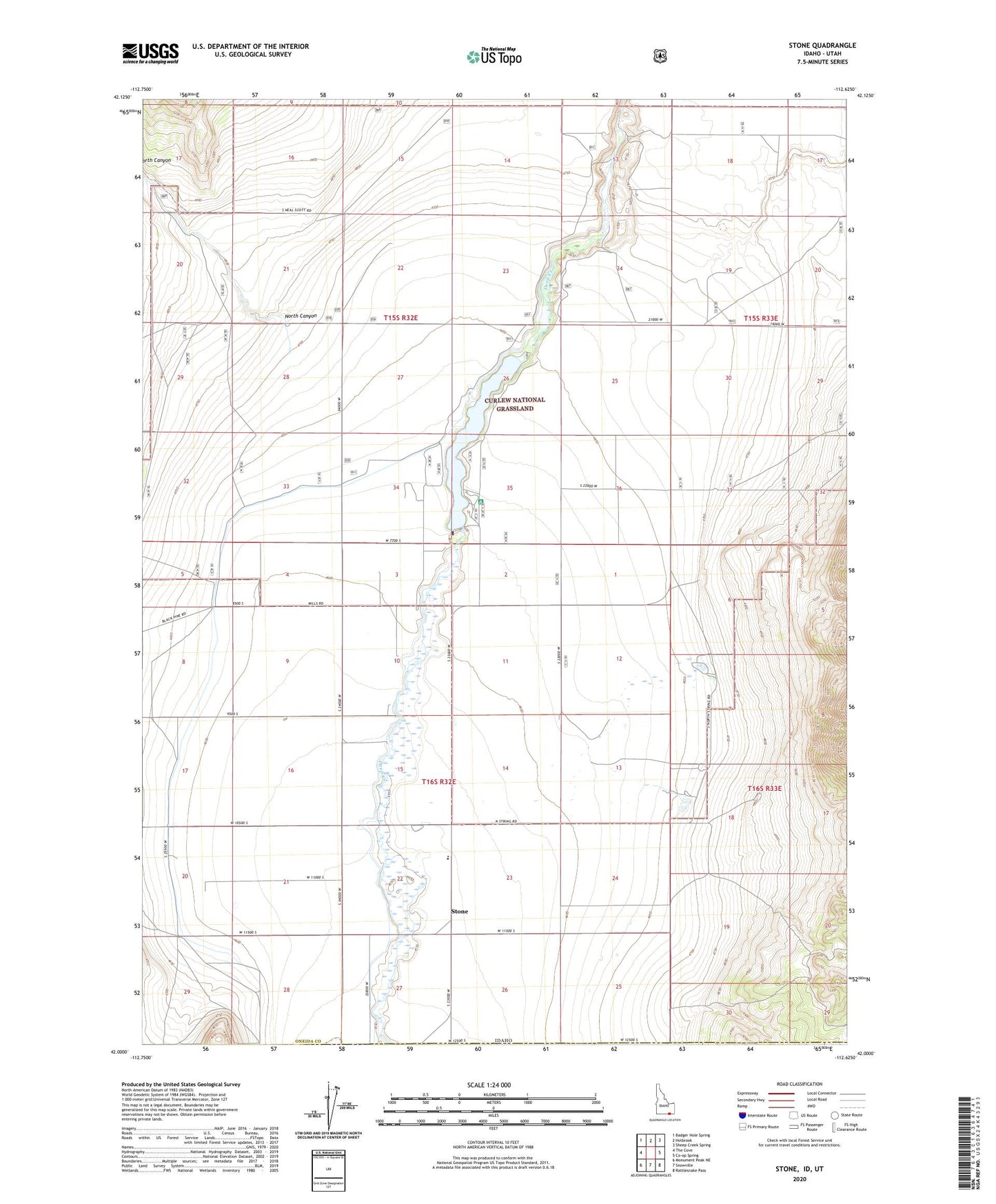
Stone Idaho US Topo Map
Couldn't load pickup availability
Also explore the Stone Forest Service Topo of this same quad for updated USFS data
2023 topographic map quadrangle Stone in the state of Idaho. Scale: 1:24000. Based on the newly updated USGS 7.5' US Topo map series, this map is in the following counties: Oneida, Box Elder. The map contains contour data, water features, and other items you are used to seeing on USGS maps, but also has updated roads and other features. This is the next generation of topographic maps. Printed on high-quality waterproof paper with UV fade-resistant inks.
Quads adjacent to this one:
West: The Cove
Northwest: Badger Hole Spring
North: Holbrook
Northeast: Sheep Creek Spring
East: Co-op Spring
Southeast: Rattlesnake Pass
South: Snowville
Southwest: Monument Peak NE
Contains the following named places: Curlew Campground, Grandine Ranger Station, Nelson, North Canyon, Stone, Stone Elementary School, Stone Reservoir, Sweeten Reservoir