MyTopo
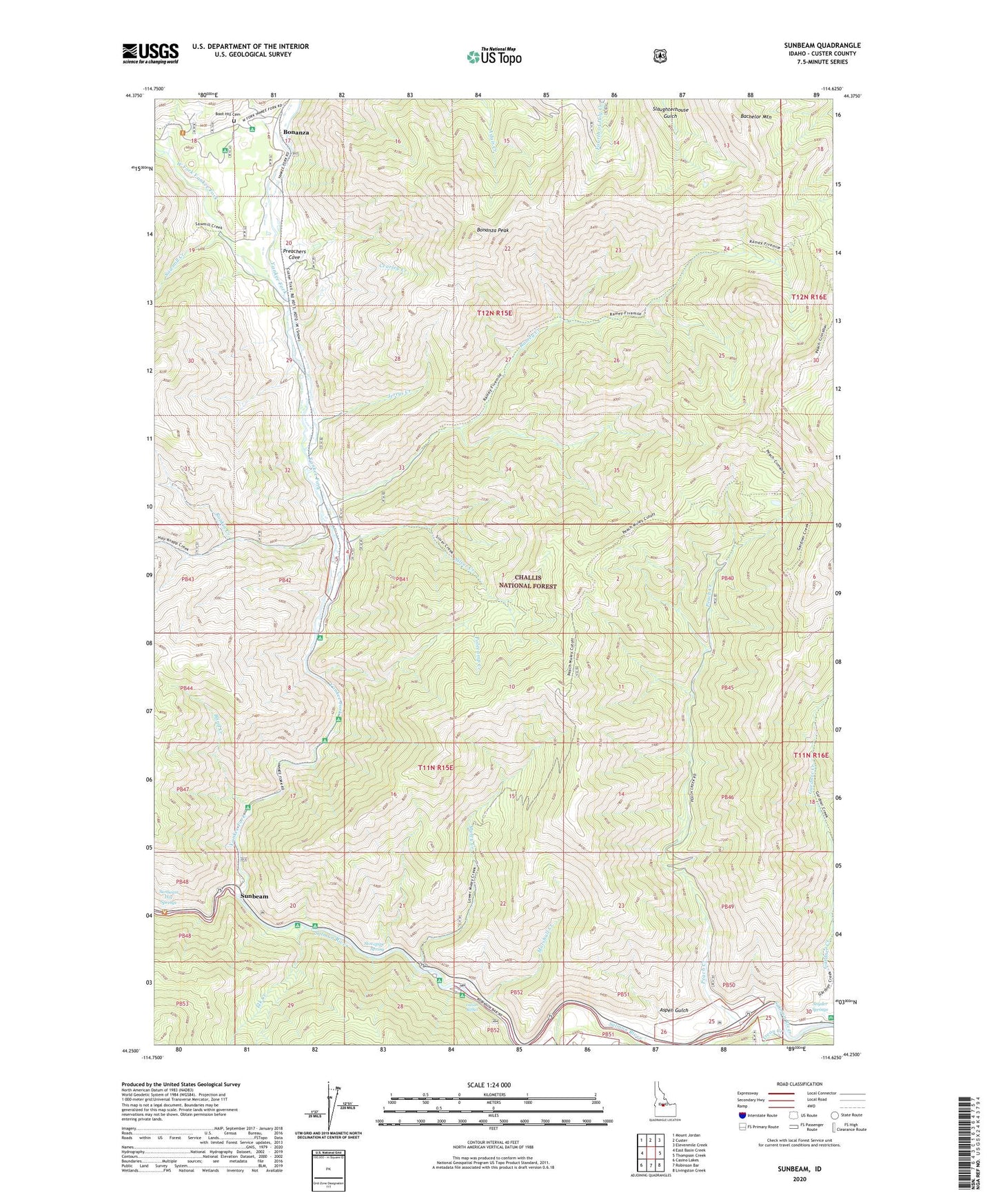
Sunbeam Idaho US Topo Map
Couldn't load pickup availability
Also explore the Sunbeam Forest Service Topo of this same quad for updated USFS data
2024 topographic map quadrangle Sunbeam in the state of Idaho. Scale: 1:24000. Based on the newly updated USGS 7.5' US Topo map series, this map is in the following counties: Custer. The map contains contour data, water features, and other items you are used to seeing on USGS maps, but also has updated roads and other features. This is the next generation of topographic maps. Printed on high-quality waterproof paper with UV fade-resistant inks.
Quads adjacent to this one:
West: East Basin Creek
Northwest: Mount Jordan
North: Custer
Northeast: Elevenmile Creek
East: Thompson Creek
Southeast: Livingston Creek
South: Robinson Bar
Southwest: Casino Lakes
This map covers the same area as the classic USGS quad with code o44114c6.
Contains the following named places: Aspen Gulch, Bachelor Mountain, Blind Creek, Blind Creek Campground, Bonanza, Bonanza Guard Station, Bonanza Peak, Boot Hill Cemetery, Cearley Creek, Dutchman Flat Campground, Elk Creek, Elk Creek Floatboat Access, Flat Rock Campground, Indian Riffles, Jerrys Creek, Lower O'Brien Campground, Lucky Boy Mine, Marshall Creek, Marshall Creek Campground, Muley Creek, Peach Creek, Polecamp Creek, Polecamp Flat Campground, Preachers Cove, Ramey Creek, Rankin Creek, Sawmill Creek, Silver Creek, Snyder Springs, Snyder Springs Picnic Area, Stovepipe Spring, Sunbeam, Sunbeam Dam, Sunbeam Dam Recreation Site, Sunbeam Hot Springs, Sunbeam Post Office, Treon Creek, Upper O'brien Campground, Warm Springs Creek, West Fork Yankee Fork, Yankee Fork, Yankee Fork Recreation Site