MyTopo
Tapper Lake Idaho US Topo Map
Couldn't load pickup availability
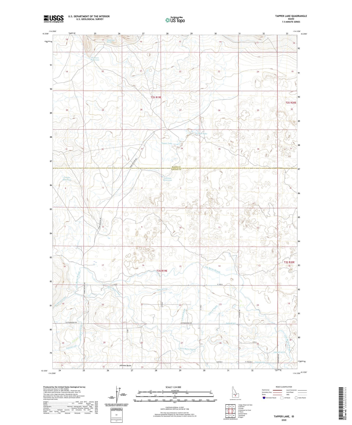
2023 topographic map quadrangle Tapper Lake in the state of Idaho. Scale: 1:24000. Based on the newly updated USGS 7.5' US Topo map series, this map is in the following counties: Lincoln, Blaine. The map contains contour data, water features, and other items you are used to seeing on USGS maps, but also has updated roads and other features. This is the next generation of topographic maps. Printed on high-quality waterproof paper with UV fade-resistant inks.
Quads adjacent to this one:
West: Shoshone Ice Cave
Northwest: Magic Reservoir East
North: Gannett
Northeast: Picabo
East: Tikura
Southeast: Pagari
South: Richfield
Southwest: Kinzie Butte
This map covers the same area as the classic USGS quad with code o43114b2.
Contains the following named places: Burns Post Office, Byrns Stratton Canal, East Main Canal, Johnson Reservoir, Lateral 731, Lateral 838, Lateral 838A, Lateral 838B, Lateral 917, Lateral 917A, Lateral 930, Mud Lake, Richfield Canal, Sagebrush Spring, Sonner Dam, Sonners Reservoir, Tapper Lake, Unique Reservoir