MyTopo
Picabo Idaho US Topo Map
Couldn't load pickup availability
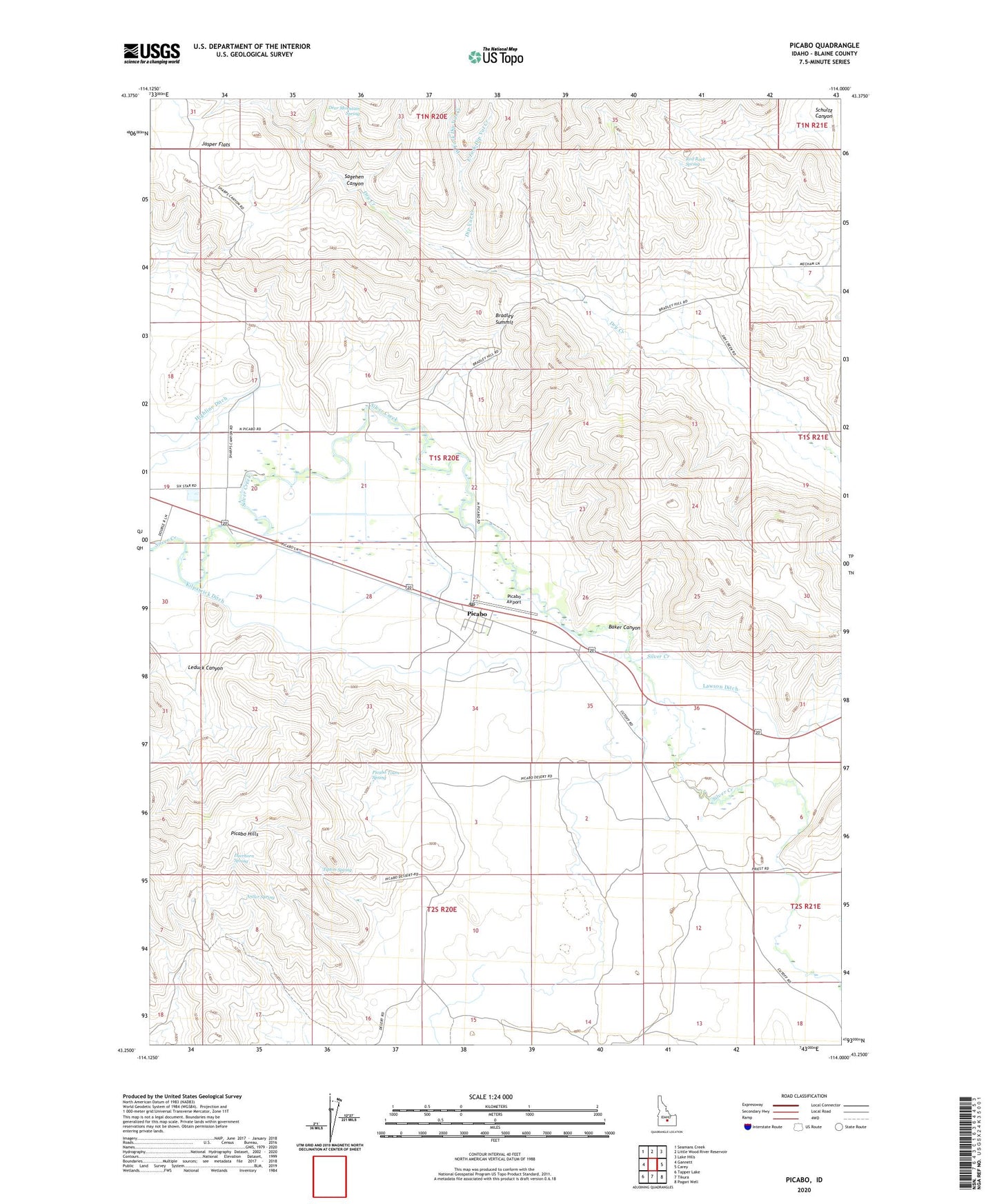
2023 topographic map quadrangle Picabo in the state of Idaho. Scale: 1:24000. Based on the newly updated USGS 7.5' US Topo map series, this map is in the following counties: Blaine. The map contains contour data, water features, and other items you are used to seeing on USGS maps, but also has updated roads and other features. This is the next generation of topographic maps. Printed on high-quality waterproof paper with UV fade-resistant inks.
Quads adjacent to this one:
West: Gannett
Northwest: Seamans Creek
North: Little Wood River Reservoir
Northeast: Lake Hills
East: Carey
Southeast: Pagari Well
South: Tikura
Southwest: Tapper Lake
This map covers the same area as the classic USGS quad with code o43114c1.
Contains the following named places: Antler Spring, Baker Canyon, Bradley Summit, Deer Mountain Spring, Deerhorn Spring, Dip Vat Creek, East Fork Dip Vat Creek, East Fork Dry Creek, Jasper Flats, Kilpatrick Ditch, Lawson Ditch, Leduc, Leduck Canyon, Picabo, Picabo Airport, Picabo Post Office, Picabo Town Spring, Point of Rocks, Priest Station, Red Rock Spring, Sagehen Canyon, Schultz Canyon, Silver Creek Access Area, Tikura Well, Tipton Spring, West Fork Dip Vat Creek