MyTopo
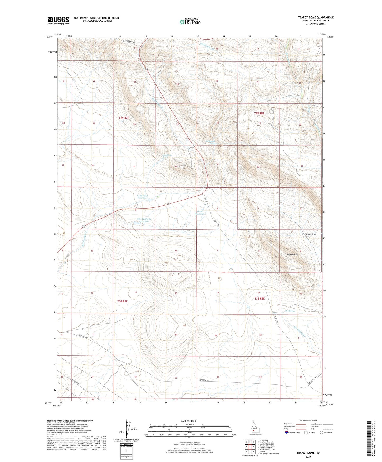
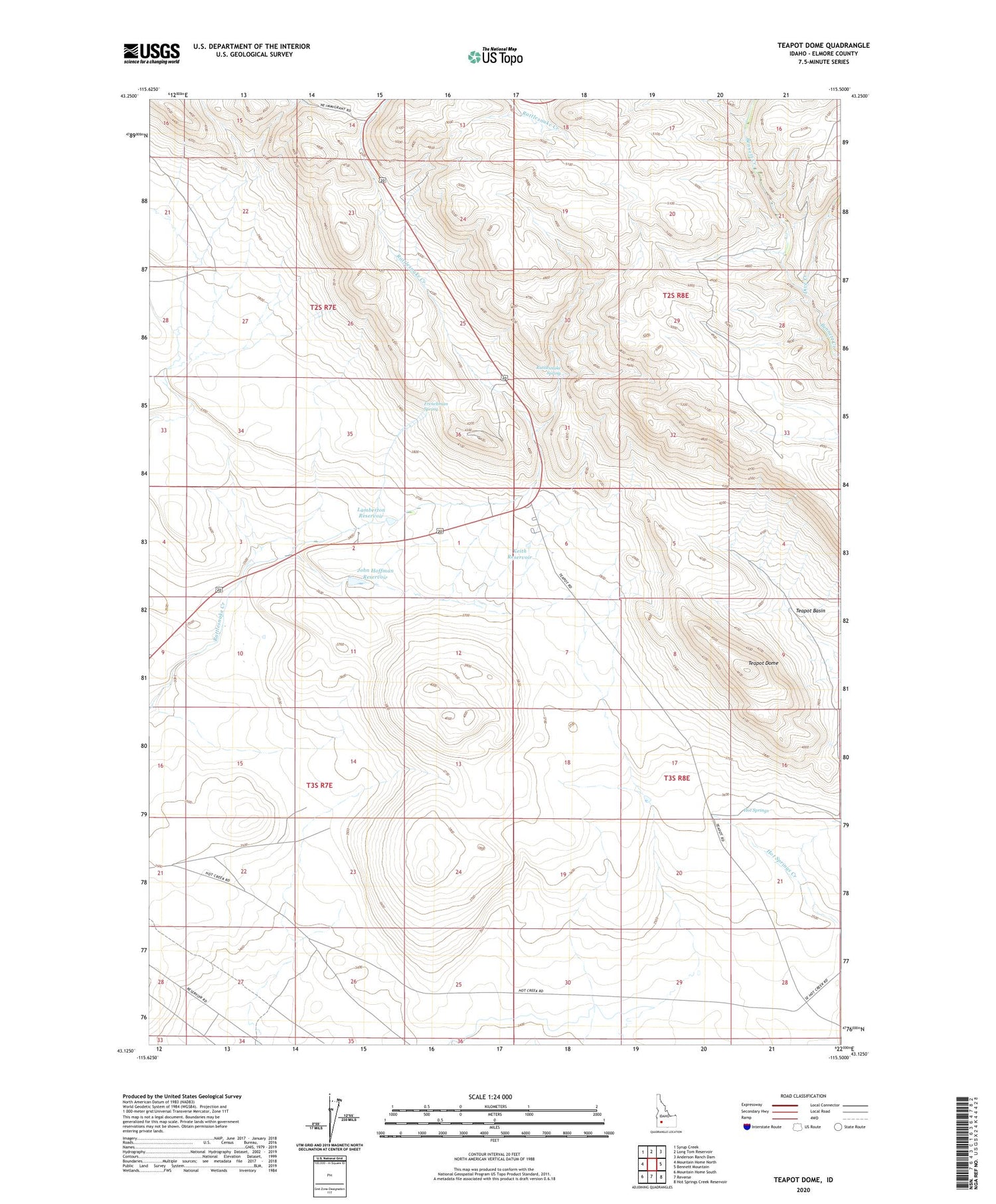
Teapot Dome Idaho US Topo Map
Couldn't load pickup availability
2023 topographic map quadrangle Teapot Dome in the state of Idaho. Scale: 1:24000. Based on the newly updated USGS 7.5' US Topo map series, this map is in the following counties: Elmore. The map contains contour data, water features, and other items you are used to seeing on USGS maps, but also has updated roads and other features. This is the next generation of topographic maps. Printed on high-quality waterproof paper with UV fade-resistant inks.
Quads adjacent to this one:
West: Mountain Home North
Northwest: Syrup Creek
North: Long Tom Reservoir
Northeast: Anderson Ranch Dam
East: Bennett Mountain
Southeast: Hot Springs Creek Reservoir
South: Reverse
Southwest: Mountain Home South
This map covers the same area as the classic USGS quad with code o43115b5.
Contains the following named places: Dive Creek, Frenchman Spring, Hoffman and Duffy Dam, Hot Springs, John Hoffman Reservoir, Keith Reservoir, KLVJ-FM (Mountain Home), Lamberton Reservoir, Oregon Trail Historical Marker, Rattlesnake Spring, Teapot Basin, Teapot Dome