MyTopo
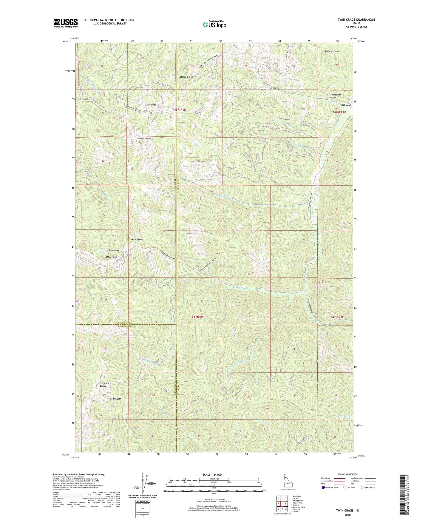
Twin Crags Idaho US Topo Map
Couldn't load pickup availability
Also explore the Twin Crags Forest Service Topo of this same quad for updated USFS data
2024 topographic map quadrangle Twin Crags in the state of Idaho. Scale: 1:24000. Based on the newly updated USGS 7.5' US Topo map series, this map is in the following counties: Shoshone, Kootenai, Benewah. The map contains contour data, water features, and other items you are used to seeing on USGS maps, but also has updated roads and other features. This is the next generation of topographic maps. Printed on high-quality waterproof paper with UV fade-resistant inks.
Quads adjacent to this one:
West: Rochat Peak
Northwest: Rose Lake
North: Cataldo
Northeast: Kellogg West
East: Masonia
Southeast: Calder
South: Saint Joe
Southwest: Saint Joe Baldy
This map covers the same area as the classic USGS quad with code o47116d3.
Contains the following named places: Bear Creek, Calusa Creek, Frost Peak, Frost Peak Lookout, Jackass Creek, Langlois Creek, Latour Baldy, Latour Peak, Middle Fork Pine Creek, Mirror Lake, Mount Wiessner, Palisade Mine, Ross Gulch, Saint Joe Divide, Sourdough Gulch, Twin Crags, West Fork Pine Creek