MyTopo
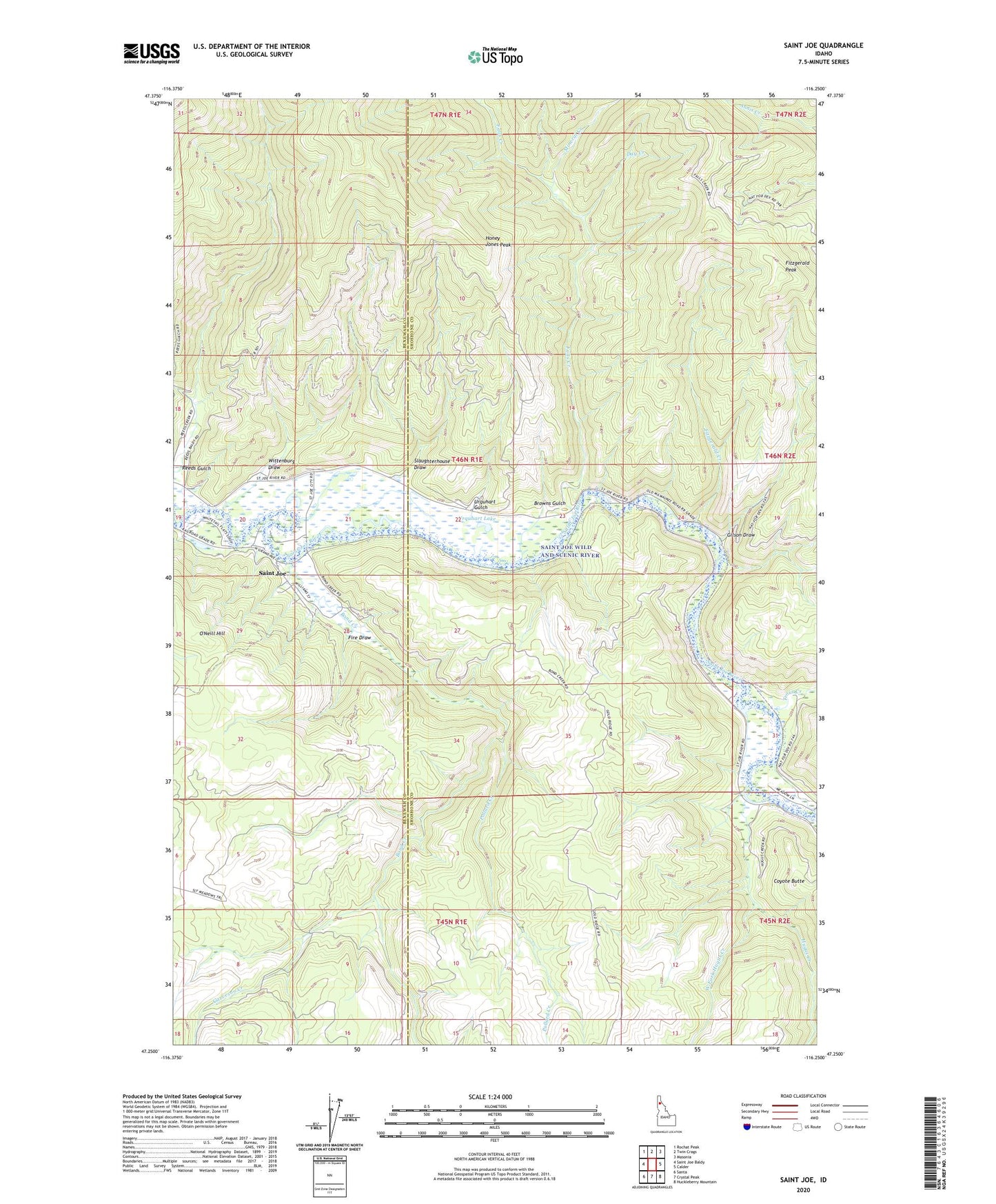
Saint Joe Idaho US Topo Map
Couldn't load pickup availability
Also explore the Saint Joe Forest Service Topo of this same quad for updated USFS data
2024 topographic map quadrangle Saint Joe in the state of Idaho. Scale: 1:24000. Based on the newly updated USGS 7.5' US Topo map series, this map is in the following counties: Shoshone, Benewah. The map contains contour data, water features, and other items you are used to seeing on USGS maps, but also has updated roads and other features. This is the next generation of topographic maps. Printed on high-quality waterproof paper with UV fade-resistant inks.
Quads adjacent to this one:
West: Saint Joe Baldy
Northwest: Rochat Peak
North: Twin Crags
Northeast: Masonia
East: Calder
Southeast: Huckleberry Mountain
South: Crystal Peak
Southwest: Santa
This map covers the same area as the classic USGS quad with code o47116c3.
Contains the following named places: Bond Creek, Browns Gulch, Coyote Butte, Day Creek, Falls Creek, Ferrel, Fire Draw, Fitzgerald Creek, Fitzgerald Peak, Garveson Creek, Gilson Draw, Honey Jones Peak, Honey Jones Ridge, Hugus Creek, Mineral Creek, O'Neill Hill, Pollard Creek, Reeds Gulch, Saint Joe, Slaughterhouse Draw, Trout Creek, Urquhart Gulch, Urquhart Lake, West Fork Hugus Creek, Wittenburg Draw