
MyTopo
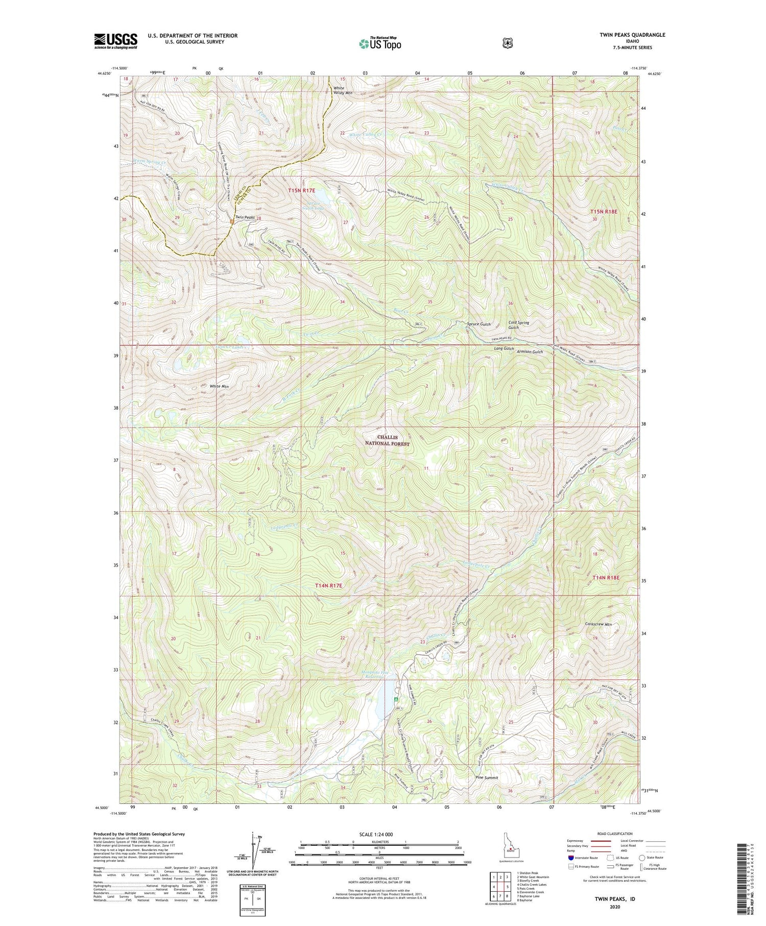
Twin Peaks Idaho US Topo Map
Couldn't load pickup availability
Also explore the Twin Peaks Forest Service Topo of this same quad for updated USFS data
2024 topographic map quadrangle Twin Peaks in the state of Idaho. Scale: 1:24000. Based on the newly updated USGS 7.5' US Topo map series, this map is in the following counties: Custer, Lemhi. The map contains contour data, water features, and other items you are used to seeing on USGS maps, but also has updated roads and other features. This is the next generation of topographic maps. Printed on high-quality waterproof paper with UV fade-resistant inks.
Quads adjacent to this one:
West: Challis Creek Lakes
Northwest: Sheldon Peak
North: White Goat Mountain
Northeast: Blowfly Creek
East: Pats Creek
Southeast: Bayhorse
South: Bayhorse Lake
Southwest: Elevenmile Creek
This map covers the same area as the classic USGS quad with code o44114e4.
Contains the following named places: Armison Gulch, Cold Spring Gulch, Corkscrew Mountain, Lang Gulch, Lodgepole Creek, Lookout Cabin, Mosquito Flat Dam, Mosquito Flat Reservoir, Pine Summit, Spruce Gulch, Spruce Gulch Lake, Twin Creek, Twin Creek Lakes, Twin Peaks, Twin Peaks Lookout, Twin Peaks Recreation Site, West Fork Creek, White Mountain, White Valley Mountain


