MyTopo
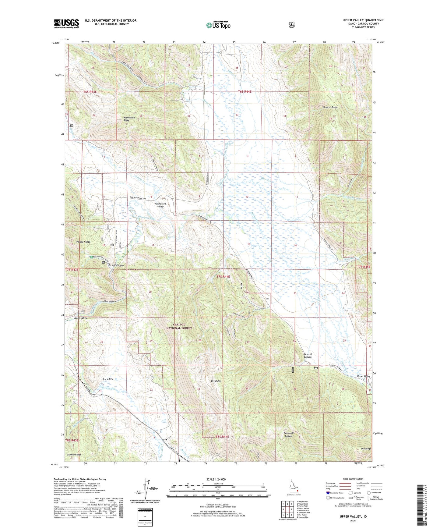
Upper Valley Idaho US Topo Map
Couldn't load pickup availability
Also explore the Upper Valley Forest Service Topo of this same quad for updated USFS data
2023 topographic map quadrangle Upper Valley in the state of Idaho. Scale: 1:24000. Based on the newly updated USGS 7.5' US Topo map series, this map is in the following counties: Caribou. The map contains contour data, water features, and other items you are used to seeing on USGS maps, but also has updated roads and other features. This is the next generation of topographic maps. Printed on high-quality waterproof paper with UV fade-resistant inks.
Quads adjacent to this one:
West: Lower Valley
Northwest: Wayan West
North: Wayan East
Northeast: Stump Peak
East: Diamond Flat
Southeast: Stewart Flat
South: Dry Valley
Southwest: Johnson Creek
This map covers the same area as the classic USGS quad with code o42111g3.
Contains the following named places: Angus Creek, Bacon Creek, Cabin Creek, Chicken Creek, Diamond Creek, Dry Valley, Dry Valley Trail, Kendall Canyon, Lanes Creek, Mabey Creek, Maybey Canyon Phosphate Mining Area, Mill Canyon, Mill Canyon Campground, Rasmussen Valley, Sheep Creek, South Fork Bacon Creek, South Fork Campbell Canyon, South Fork Sheep Creek, Stocking Ranch, The Narrows, Timothy Creek, Trail Guard Station, Wayan Division