MyTopo
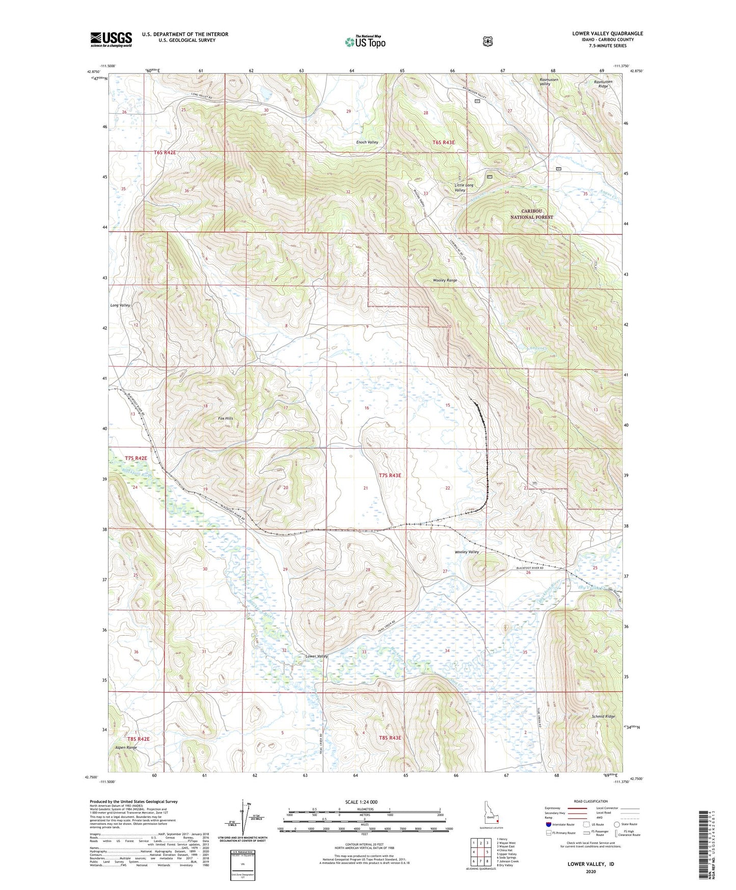
Lower Valley Idaho US Topo Map
Couldn't load pickup availability
Also explore the Lower Valley Forest Service Topo of this same quad for updated USFS data
2023 topographic map quadrangle Lower Valley in the state of Idaho. Scale: 1:24000. Based on the newly updated USGS 7.5' US Topo map series, this map is in the following counties: Caribou. The map contains contour data, water features, and other items you are used to seeing on USGS maps, but also has updated roads and other features. This is the next generation of topographic maps. Printed on high-quality waterproof paper with UV fade-resistant inks.
Quads adjacent to this one:
West: China Hat
Northwest: Henry
North: Wayan West
Northeast: Wayan East
East: Upper Valley
Southeast: Dry Valley
South: Johnson Creek
Southwest: Soda Springs
This map covers the same area as the classic USGS quad with code o42111g4.
Contains the following named places: Allen Ranch, Dry Valley Creek, Fox Hills, Fox Ranch, Little Long Valley, Lower Valley, R Allen Ranch, Slug Creek, Stocking Ranch, Strong Ranch, Trail Creek, Unit Three Haulroad Dam, West Steadman Ranch, Wooley Range, Wooley Valley