MyTopo
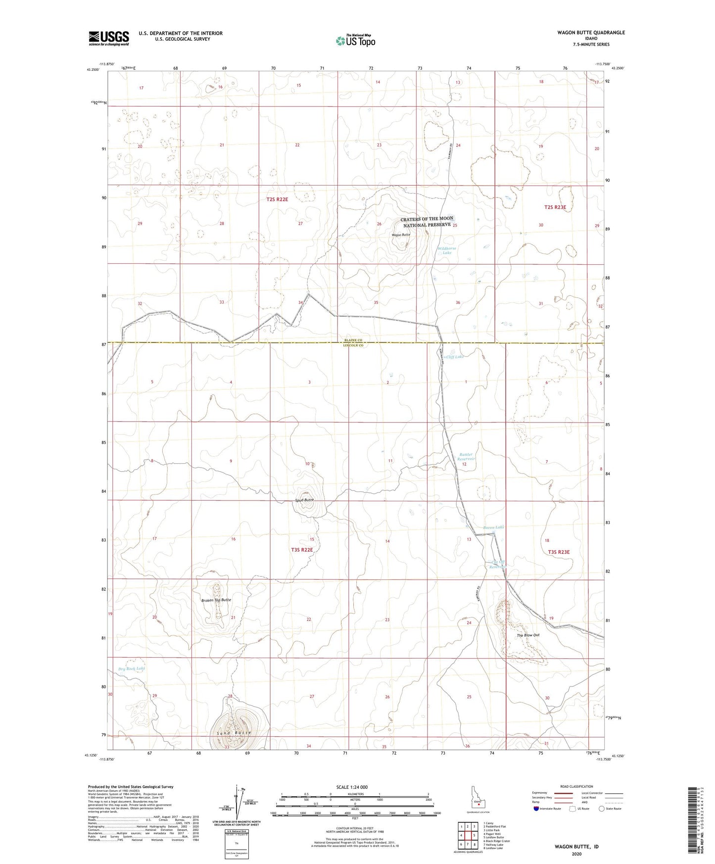
Wagon Butte Idaho US Topo Map
Couldn't load pickup availability
2023 topographic map quadrangle Wagon Butte in the state of Idaho. Scale: 1:24000. Based on the newly updated USGS 7.5' US Topo map series, this map is in the following counties: Lincoln, Blaine. The map contains contour data, water features, and other items you are used to seeing on USGS maps, but also has updated roads and other features. This is the next generation of topographic maps. Printed on high-quality waterproof paper with UV fade-resistant inks.
Quads adjacent to this one:
West: Pagari Well
Northwest: Carey
North: Paddelford Flat
Northeast: Little Park
East: Laidlaw Butte
Southeast: Laidlaw Lake
South: Halfway Lake
Southwest: Black Ridge Crater
This map covers the same area as the classic USGS quad with code o43113b7.
Contains the following named places: Bacon Lake, Broken Top Butte, Cliff Lake, Cut Off Reservoir, Dry Rock Lake, Rattler Reservoir, Sand Butte, Spud Butte, The Blow Out, Wagon Butte, Wildhorse Lake