MyTopo
Carey Idaho US Topo Map
Couldn't load pickup availability
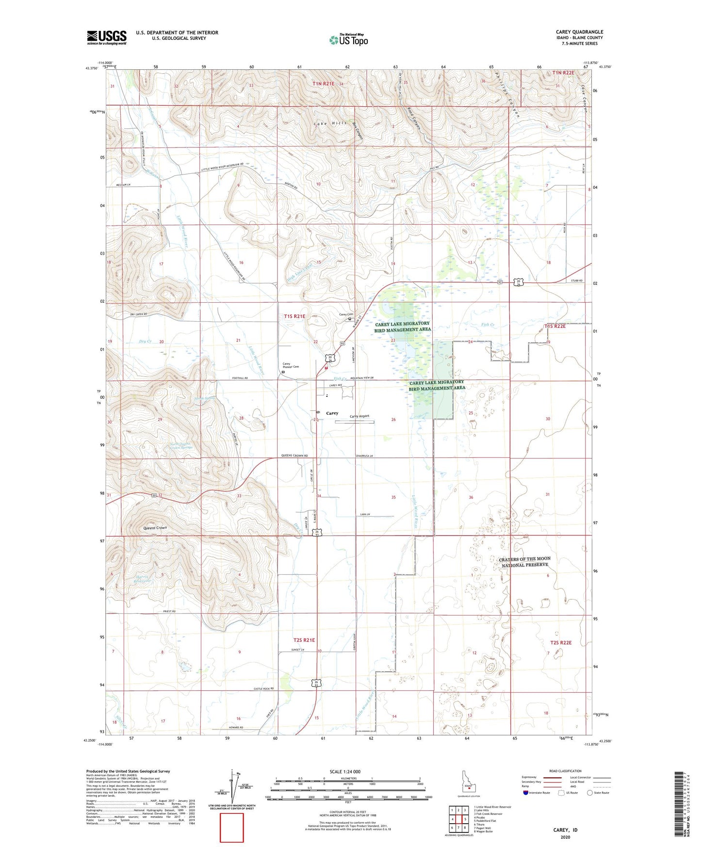
2023 topographic map quadrangle Carey in the state of Idaho. Scale: 1:24000. Based on the newly updated USGS 7.5' US Topo map series, this map is in the following counties: Blaine. The map contains contour data, water features, and other items you are used to seeing on USGS maps, but also has updated roads and other features. This is the next generation of topographic maps. Printed on high-quality waterproof paper with UV fade-resistant inks.
Quads adjacent to this one:
West: Picabo
Northwest: Little Wood River Reservoir
North: Lake Hills
Northeast: Fish Creek Reservoir
East: Paddelford Flat
Southeast: Wagon Butte
South: Pagari Well
Southwest: Tikura
This map covers the same area as the classic USGS quad with code o43113c8.
Contains the following named places: Blaine County Fairgrounds, Box Canyon, Bureau of Land Management - Carey Fire Station, Carey, Carey Airport, Carey Cemetery, Carey Lake, Carey Lake Migratory Bird Management Area, Carey Lake Wildlife Management Area, Carey Pioneer Cemetery, Carey Post Office, Carey Public School, Case Canyon, City of Carey, Dry Creek, Fish Creek, Harris Reservoir, Hot Springs Ranch, North Queens Crown Springs, Phillips Canyon, Queens Crown, Road Canyon, Strode Spring