MyTopo
Huckleberry Butte Idaho US Topo Map
Couldn't load pickup availability
Also explore the Huckleberry Butte Forest Service Topo of this same quad for updated USFS data
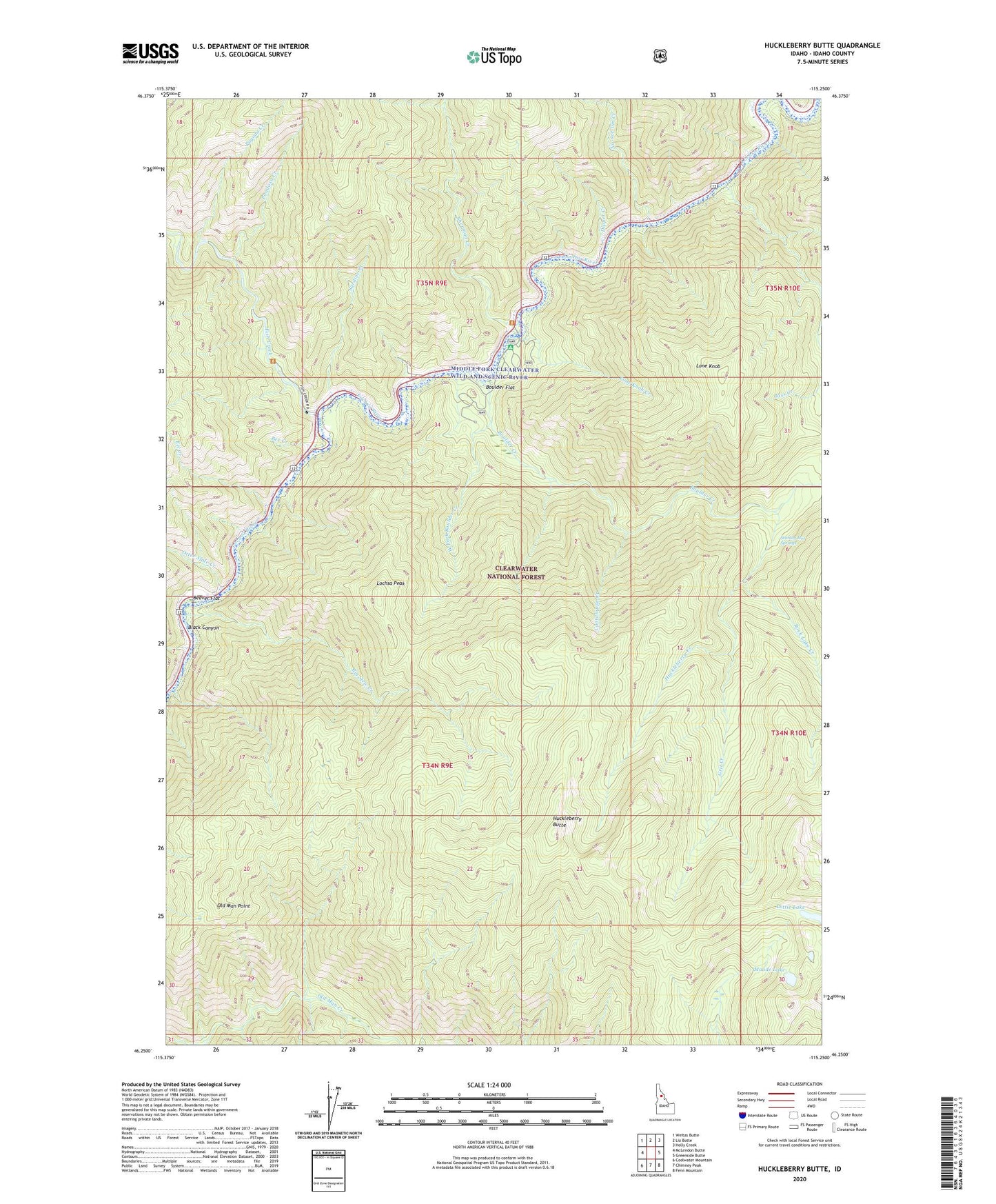
2024 topographic map quadrangle Huckleberry Butte in the state of Idaho. Scale: 1:24000. Based on the newly updated USGS 7.5' US Topo map series, this map is in the following counties: Idaho. The map contains contour data, water features, and other items you are used to seeing on USGS maps, but also has updated roads and other features. This is the next generation of topographic maps. Printed on high-quality waterproof paper with UV fade-resistant inks.
Quads adjacent to this one:
West: McLendon Butte
Northwest: Weitas Butte
North: Liz Butte
Northeast: Holly Creek
East: Greenside Butte
Southeast: Fenn Mountain
South: Chimney Peak
Southwest: Coolwater Mountain
This map covers the same area as the classic USGS quad with code o46115c3.
Contains the following named places: Beaver Flat, Bee Creek, Big Stew Creek, Boulder Creek, Boulder Flat, Cantaloupe Creek, Dipper Creek, Eel Creek, Fish Creek, Five Island, Grit Creek, Huckleberry Butte, Huckleberry Creek, Lochsa Historical Station, Lochsa Peak, Lochsa Work Center, Lone Knob, Lone Knob Creek, Lottie Lake, Maude Lake, No-see-um Creek, Old Man Point, Otter Slide Creek, Pagoda Creek, Pass Creek, Pondosa Creek, Rock Lake Creek, Sardine Creek, Sherman Creek, Snowshoe Creek, Stanley Hot Springs, West Fork Boulder Creek, Wilderness Gateway Pack Bridge