MyTopo
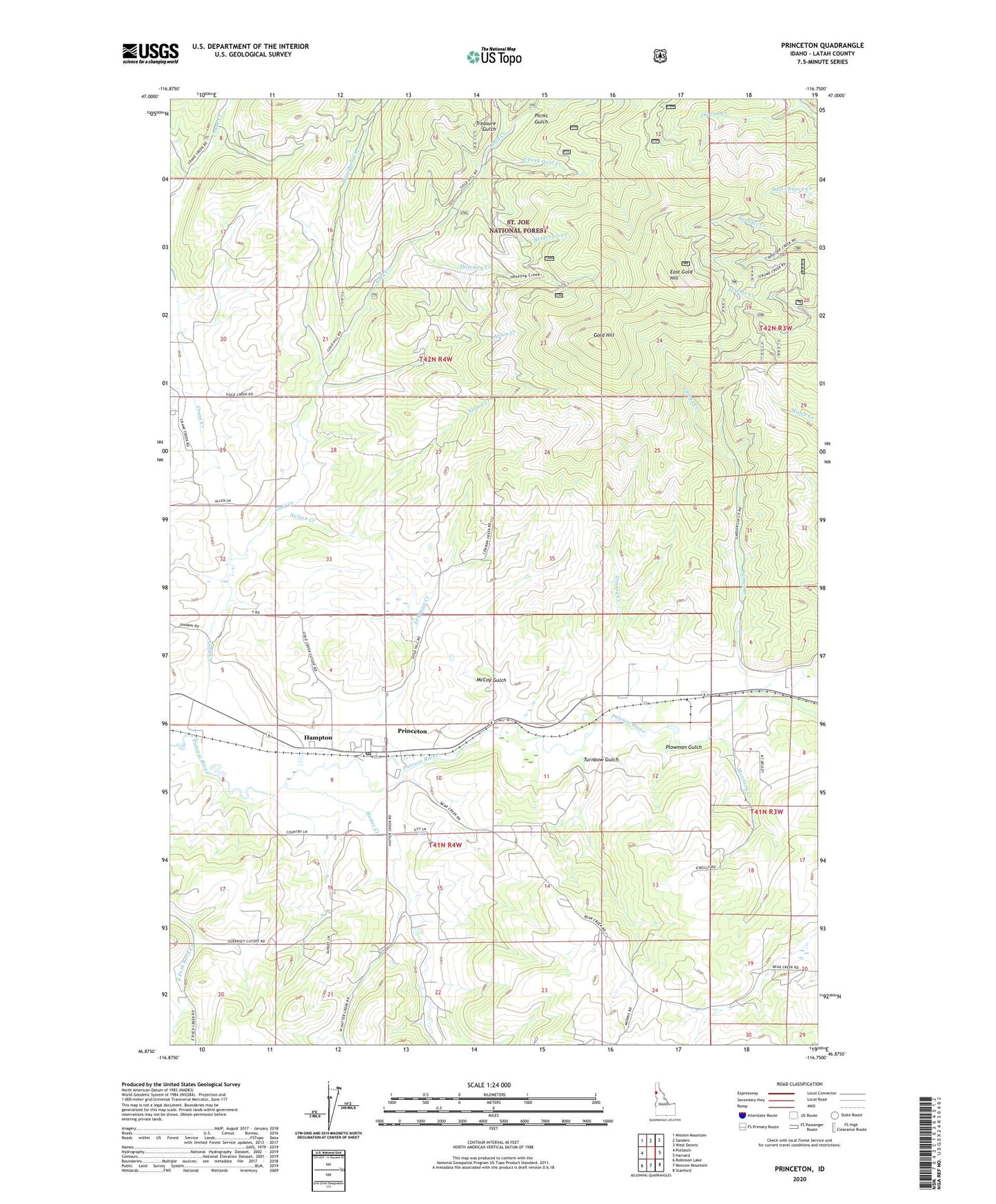
Princeton Idaho US Topo Map
Couldn't load pickup availability
Also explore the Princeton Forest Service Topo of this same quad for updated USFS data
2024 topographic map quadrangle Princeton in the state of Idaho. Scale: 1:24000. Based on the newly updated USGS 7.5' US Topo map series, this map is in the following counties: Latah. The map contains contour data, water features, and other items you are used to seeing on USGS maps, but also has updated roads and other features. This is the next generation of topographic maps. Printed on high-quality waterproof paper with UV fade-resistant inks.
Quads adjacent to this one:
West: Potlatch
Northwest: Mission Mountain
North: Sanders
Northeast: West Dennis
East: Harvard
Southeast: Stanford
South: Moscow Mountain
Southwest: Robinson Lake
This map covers the same area as the classic USGS quad with code o46116h7.
Contains the following named places: Arson Creek, Camas Creek, Carrico Mine, Chambers, Crane Creek, East Fork Gold Creek, East Gold Hill, East Gold Lookout, Gold Creek, Gold Hill, Grouse Creek, Hampton, Hatter Creek, Hoteling Creek, Jacks Gulch, Kings Landing, Lemman Creek, Lost Wheelbarrow Mine, McCoy Gulch, Morrisey Creek, Morrissey Siding, Nelson Creek, Olevan Creek, Picnic Gulch, Plowman Gulch, Potlatch Division, Princeton, Princeton Census Designated Place, Princeton Post Office, Reservoir Creek, Treasure Gulch, Turnbow Gulch, Waterhole Creek, ZIP Code: 83857