MyTopo
Woodville Idaho US Topo Map
Couldn't load pickup availability
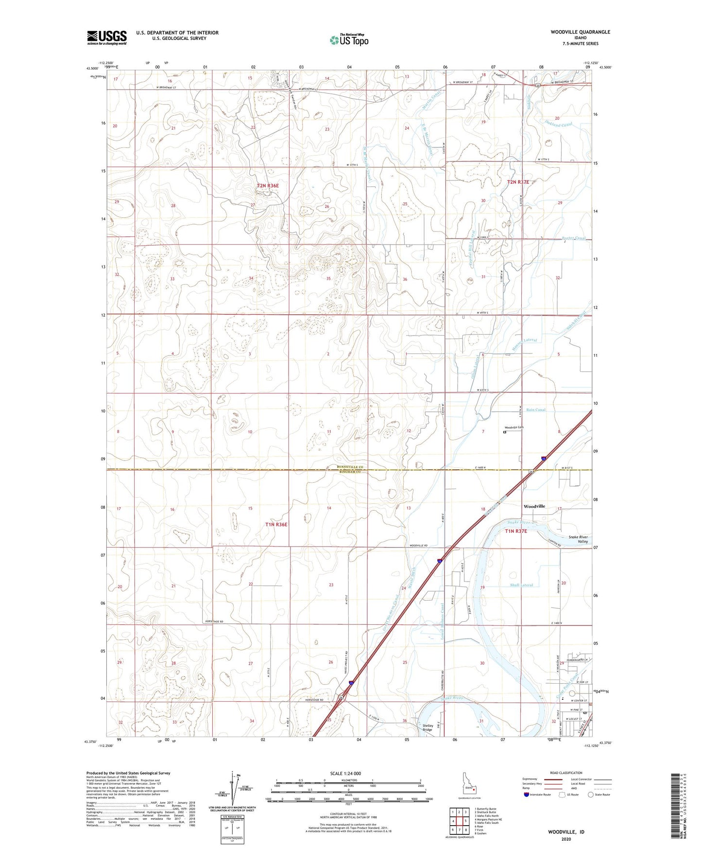
2024 topographic map quadrangle Woodville in the state of Idaho. Scale: 1:24000. Based on the newly updated USGS 7.5' US Topo map series, this map is in the following counties: Bonneville, Bingham. The map contains contour data, water features, and other items you are used to seeing on USGS maps, but also has updated roads and other features. This is the next generation of topographic maps. Printed on high-quality waterproof paper with UV fade-resistant inks.
Quads adjacent to this one:
West: Morgans Pasture NE
Northwest: Butterfly Butte
North: Shattuck Butte
Northeast: Idaho Falls North
East: Idaho Falls South
Southeast: Goshen
South: Firth
Southwest: Rose
This map covers the same area as the classic USGS quad with code o43112d2.
Contains the following named places: Bain Canal, Capital Hill Lateral, City of Shelley, East Branch Martin Canal, Great Western Canal, Hansen Lateral, Hazel Stuart Elementary School, Lower Holmes Canal, Oakland Waste, Olson Lateral, Shelley Bridge, Shelley Police Department, Shelley Post Office, Shull Lateral, Sinkhole, The Slough, Waste Ditch, West Branch Martin Canal, Woodville, Woodville Canal, Woodville Cemetery