MyTopo
Idaho Falls South Idaho US Topo Map
Couldn't load pickup availability
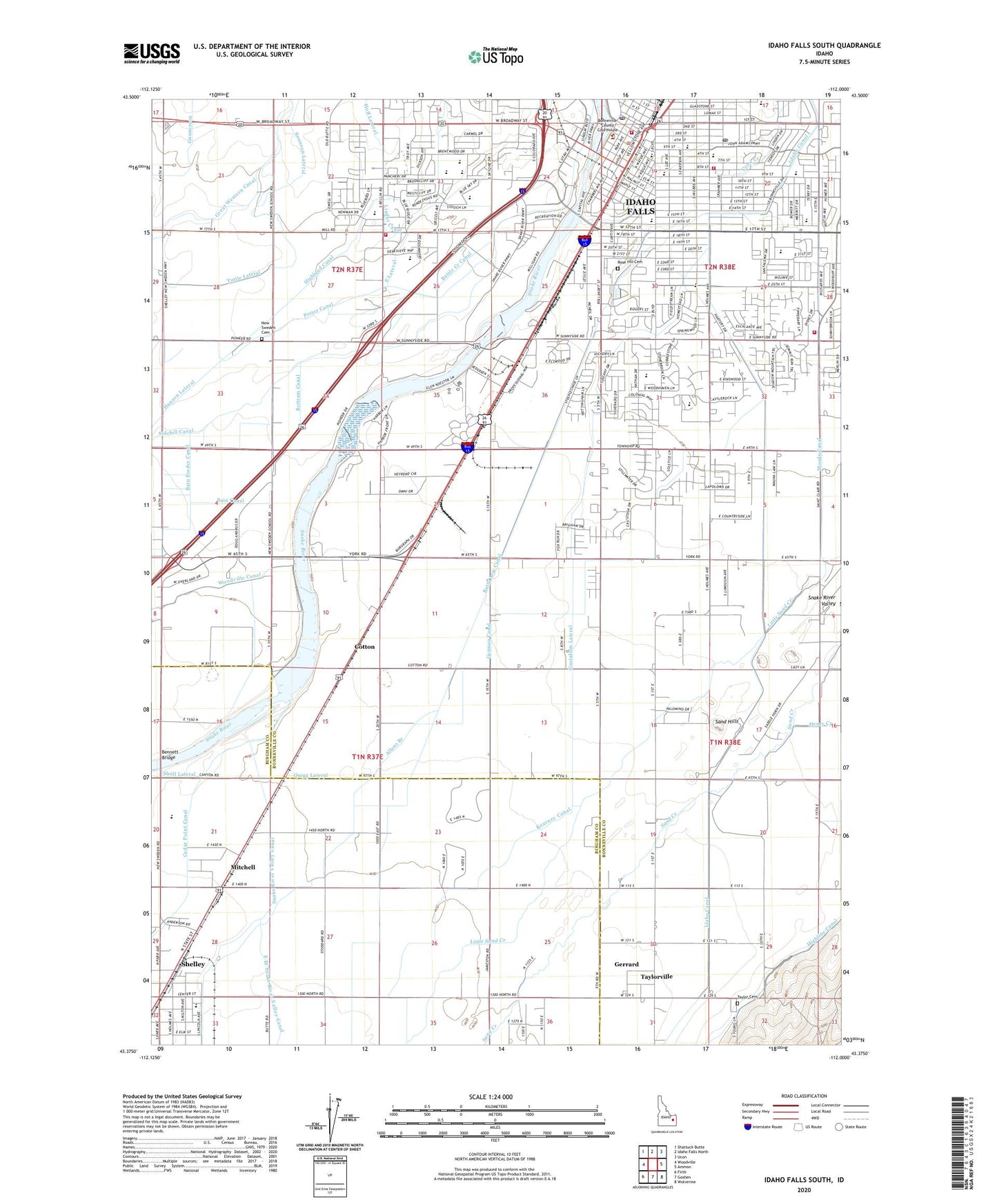
2024 topographic map quadrangle Idaho Falls South in the state of Idaho. Scale: 1:24000. Based on the newly updated USGS 7.5' US Topo map series, this map is in the following counties: Bonneville, Bingham. The map contains contour data, water features, and other items you are used to seeing on USGS maps, but also has updated roads and other features. This is the next generation of topographic maps. Printed on high-quality waterproof paper with UV fade-resistant inks.
Quads adjacent to this one:
West: Woodville
Northwest: Shattuck Butte
North: Idaho Falls North
Northeast: Ucon
East: Ammon
Southeast: Wolverine
South: Goshen
Southwest: Firth
This map covers the same area as the classic USGS quad with code o43112d1.
Contains the following named places: Adventist Christian School, Allens Branch, Bain Feeder Canal, Battle Creek Canal, Bennett Bridge, Bertram Canal, Bonneville County Sheriff's Office, Butte Arm Canal, Capitol Avenue Green Belt, City of Idaho Falls, Continuation School-Alternate School, Cotton, Crow Creek, Curley Park, Dean Goodsell Primary School, Development Workshop Incorporated, Donald J Hobbs Middle School, Dora Erickson Elementary School, Eagle Rock Junior High School, Eagle Rock Post Office, Eagle Rock School, East Side School, Edgemont Elementary School, Elm Street Park, Emerson Elementary School, Ethel Boyes School, Family Emergency Center West, Fox Hollow Elementary School, Gem State Access Area, German Canal, Gerrard, Gethsemane Christian School, Gustafson Lateral, Hall Park Shopping Plaza, Hawthorne School, Highland Canal, Hoff Lateral, Holy Rosary Elementary School, Human Services Center Incorporated, Idaho Canal, Idaho Falls, Idaho Falls Fire Department Station 1, Idaho Falls Fire Department Station 4, Idaho Falls Fire Department Station 5, Idaho Falls High School, Idaho Falls Police Department, Idaho Falls Post Office, Indian, Kearney Canal, Latter Day Saint Hospital, Linden Park Elementary School, Linder Canal, Longfellow Elementary School, Lower Idaho Falls Dam, Middle Idaho Falls Dam, Mitchell, Moody Canal, New Sweden Cemetery, New Sweden School, Poitevin Park, Porter Canal, Quigg Lateral, Riverdale School, Rollandet Park, Rose Hill Cemetery, Sacred Heart Hospital, Sand Hills, Sandy Downs Rodeo Grounds, Shamrock Park, Shelley, Shelley Division, Shopko, Sidehill Canal, Skyline High School, Snake River Valley Canal, South Falls Center, Stanton School, Sunnyside Elementary School, Swanson Lateral, Tautphaus Park, Taylor Cemetery, Taylor School, Taylorview Junior High School, Taylorville, Temple View Elementary School, Teton Plaza, Theresa Bunker Elementary School, Tuttle Lateral, Washington School, Westside Elementary School, York School, ZIP Code: 83404