MyTopo
Bath Illinois US Topo Map
Couldn't load pickup availability
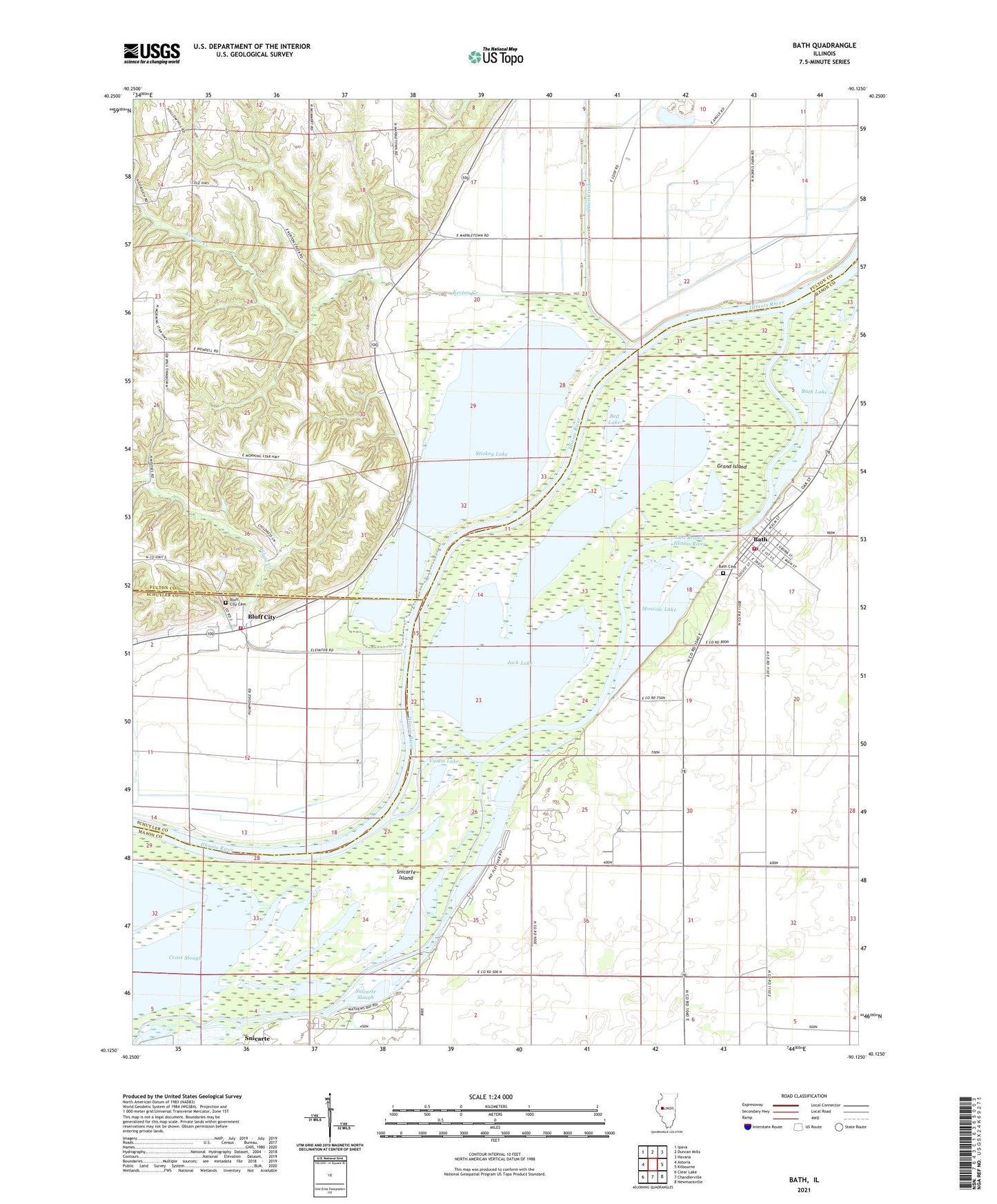
2024 topographic map quadrangle Bath in the state of Illinois. Scale: 1:24000. Based on the newly updated USGS 7.5' US Topo map series, this map is in the following counties: Mason, Fulton, Schuyler. The map contains contour data, water features, and other items you are used to seeing on USGS maps, but also has updated roads and other features. This is the next generation of topographic maps. Printed on high-quality waterproof paper with UV fade-resistant inks.
Quads adjacent to this one:
West: Astoria
Northwest: Ipava
North: Duncan Mills
Northeast: Havana
East: Kilbourne
Southeast: Newmansville
South: Chandlerville
Southwest: Clear Lake
This map covers the same area as the classic USGS quad with code o40090b2.
Contains the following named places: Anderson Lake, Anderson Lake State Conservation Area, Bath, Bath Cemetery, Bath Fire Protection District, Bath Lake, Bath Post Office, Bell Lake, Bluff City, Bluff City Cemetery, Carlson Lake, Carlson Lake Waterfowl Management Area, Chain Lake, Curtis Lake, Devils Elbow Post Light, Dixon School, East Branch Illinois River, Grand Island, Grass Lake, Hickory - Kerton Township Fire Department, Holmes Landing, Jack Lake, Kerton Creek, Lakewood Golf Course, Marbletown, Marbletown School, Mathew Bay, Moscow, Moscow Farm, Moscow Lake, North Campground, Otter Creek, Patterson Bay, Patterson School, Snicarte Island, Snicarte Slough, South Campground, Stafford Lake, Stevenson School, Stickey Lake, Swan Lake, Township of Kerton, Union School, Village of Bath, Watson School, West Matanzas School, West Point Landing, Wilson Creek, ZIP Code: 62617