MyTopo
Kilbourne Illinois US Topo Map
Couldn't load pickup availability
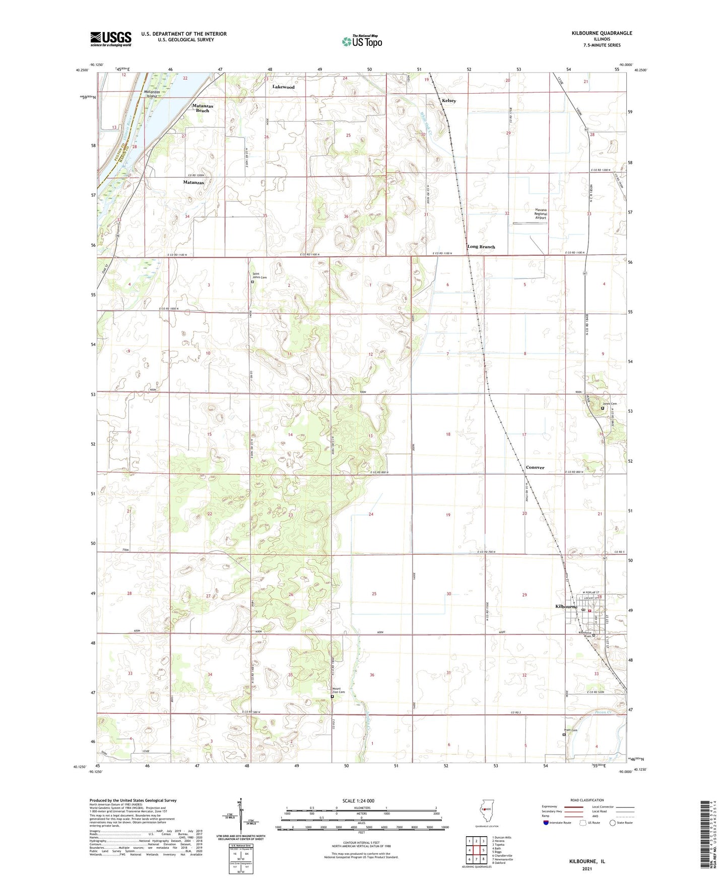
2024 topographic map quadrangle Kilbourne in the state of Illinois. Scale: 1:24000. Based on the newly updated USGS 7.5' US Topo map series, this map is in the following counties: Mason, Fulton. The map contains contour data, water features, and other items you are used to seeing on USGS maps, but also has updated roads and other features. This is the next generation of topographic maps. Printed on high-quality waterproof paper with UV fade-resistant inks.
Quads adjacent to this one:
West: Bath
Northwest: Duncan Mills
North: Havana
Northeast: Topeka
East: Biggs
Southeast: Oakford
South: Newmansville
Southwest: Chandlerville
This map covers the same area as the classic USGS quad with code o40090b1.
Contains the following named places: Conover, Dierker Lake, Frog Pond School, Hardin School, Havana Regional Airport, Johnson Landing Strip, Jones Cemetery, Jones School, Kelsey, Kilbourne, Kilbourne Baptist Church, Kilbourne Cemetery, Kilbourne Fire Department, Kilbourne Post Office, Lakewood, Long Branch, Long Branch Sand Prairie Nature Preserve, Mason County State Wildlife Refuge and Recreation Area, Matanzas, Matanzas Beach, Matanzas Lake, Matanzas Prairie Nature Preserve, Matanzas School, Mid-State Dragway, Mount Zion Cemetery, Mount Zion Church, Pratt Cemetery, Saint Johns Cemetery, Saint Johns Church, Sand Prairie - Scrub Oak Nature Preserve, Sedan Station, Township of Bath, Village of Kilbourne, White Hall School