MyTopo
Newmansville Illinois US Topo Map
Couldn't load pickup availability
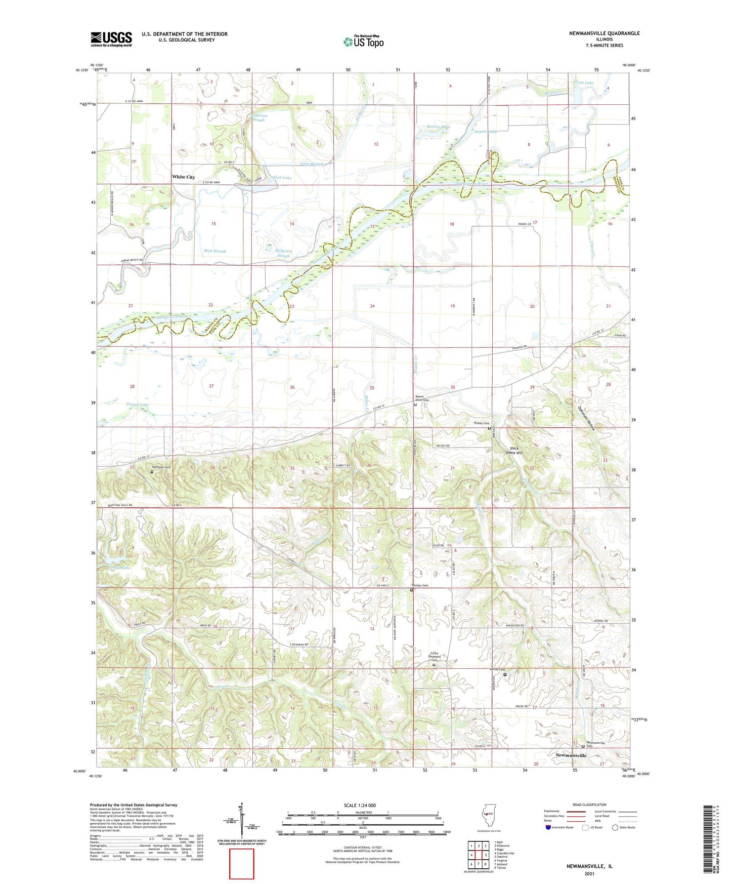
2024 topographic map quadrangle Newmansville in the state of Illinois. Scale: 1:24000. Based on the newly updated USGS 7.5' US Topo map series, this map is in the following counties: Cass, Mason. The map contains contour data, water features, and other items you are used to seeing on USGS maps, but also has updated roads and other features. This is the next generation of topographic maps. Printed on high-quality waterproof paper with UV fade-resistant inks.
Quads adjacent to this one:
West: Chandlerville
Northwest: Bath
North: Kilbourne
Northeast: Biggs
East: Oakford
Southeast: Tallula
South: Ashland
Southwest: Virginia
This map covers the same area as the classic USGS quad with code o40090a1.
Contains the following named places: Anderson School, Anderson Slough, Angelo Lake, Bowles Lake, Clary Creek, Cox Creek, Dick School, Fancher Creek, Fish Lake, Friend Lake, Harbison Cemetery, Hickey Cemetery, Jordan Creek, Jordan School, Little Shepherd Cemetery, Long Branch, Longs Lake, Longs Lake Dam, Lynn School, McHenry Slough, Middle Creek, Miller Creek, Mount Olive Cemetery, Mount Olive Church, Mud Slough, Newmansville, Newmansville Cemetery, Opossum Hollow, Pleasant Hill School, Pontiac Cemetery, Pontiac School, Pratt Lake, Shick Shack Hill, Township of Chandlerville, Township of Newmansville, Township of Panther Creek, Victory School, White City, Whitty Cemetery, Wilson School, ZIP Code: 62627