MyTopo
Brocton Illinois US Topo Map
Couldn't load pickup availability
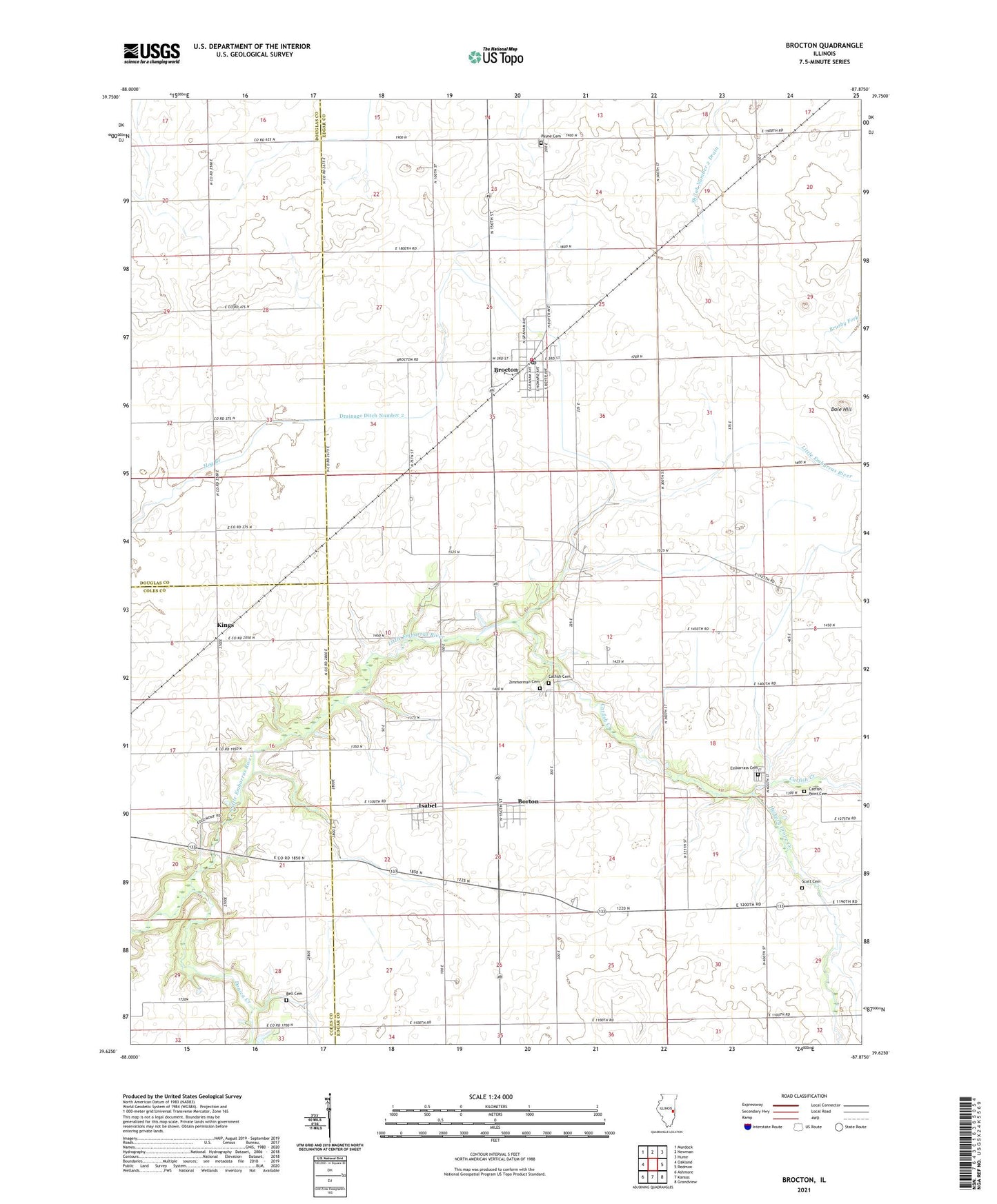
2024 topographic map quadrangle Brocton in the state of Illinois. Scale: 1:24000. Based on the newly updated USGS 7.5' US Topo map series, this map is in the following counties: Edgar, Douglas, Coles. The map contains contour data, water features, and other items you are used to seeing on USGS maps, but also has updated roads and other features. This is the next generation of topographic maps. Printed on high-quality waterproof paper with UV fade-resistant inks.
Quads adjacent to this one:
West: Oakland
Northwest: Murdock
North: Newman
Northeast: Hume
East: Redmon
Southeast: Grandview
South: Kansas
Southwest: Ashmore
This map covers the same area as the classic USGS quad with code o39087f8.
Contains the following named places: Baltimore School, Bell Cemetery, Borton, Brocton, Brocton Fire Protection District, Brocton Post Office, Catfish, Catfish Cemetery, Catfish Creek, Catfish Point Cemetery, Catfish School, Dole Hill, Dole School, Donica Creek, Drainage Ditch Number 2, East Donica School, Embarrass Cemetery, Embarrass Church, Enode School, Ewing Landing Strip, Fairplay School, Hanner School, Hickory Grove Creek, Independent School, Isabel, Kings, Lake Union School, Lamkey Landing Strip, McCollum School, Merkle School, New Athens, Payne Cemetery, Payne School, Sandridge School, Scott Cemetery, Township of Embarrass, Village of Brocton, Williams Landing Strip, Zimmerman Cemetery, ZIP Code: 61917