MyTopo
Kansas Illinois US Topo Map
Couldn't load pickup availability
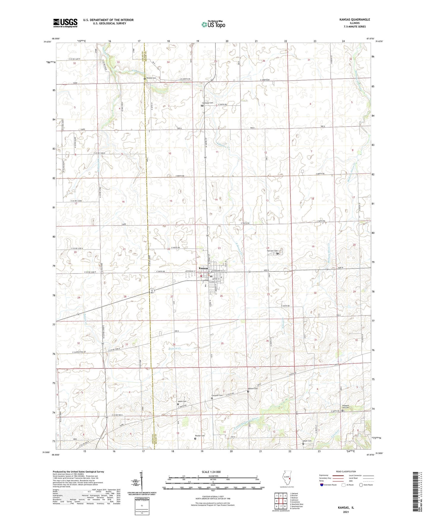
2024 topographic map quadrangle Kansas in the state of Illinois. Scale: 1:24000. Based on the newly updated USGS 7.5' US Topo map series, this map is in the following counties: Edgar, Coles. The map contains contour data, water features, and other items you are used to seeing on USGS maps, but also has updated roads and other features. This is the next generation of topographic maps. Printed on high-quality waterproof paper with UV fade-resistant inks.
Quads adjacent to this one:
West: Ashmore
Northwest: Oakland
North: Brocton
Northeast: Redmon
East: Grandview
Southeast: Clarksville
South: Westfield East
Southwest: Westfield West
This map covers the same area as the classic USGS quad with code o39087e8.
Contains the following named places: Bell School, Boyer Cemetery, College School, Cornwell Cemetery, East Donica Creek, Elm Grove, Fairview Cemetery, Gough Airport, Greenwood School, Harmony Cemetery, Harmony Church, Harmony School, Hickory Grove School, Inclose School, Kansas, Kansas Ambulance Company, Kansas Christian Church, Kansas Elementary School, Kansas Fire Protection District, Kansas High School, Kansas Post Office, Liberty School, Pleasant Hill Cemetery, Pleasant Hill Church, Pleasant Hill School, Poulter Cemetery, Prairie Union Church, Providence Church, Shields Cemetery, Shively School, Simpson School, Township of Kansas, Village of Kansas, Waite Cemetery, Walnut Grove School, Warrington, West Donica Creek, Wilhoit Cemetery, ZIP Code: 61933