MyTopo
Buckley NW Illinois US Topo Map
Couldn't load pickup availability
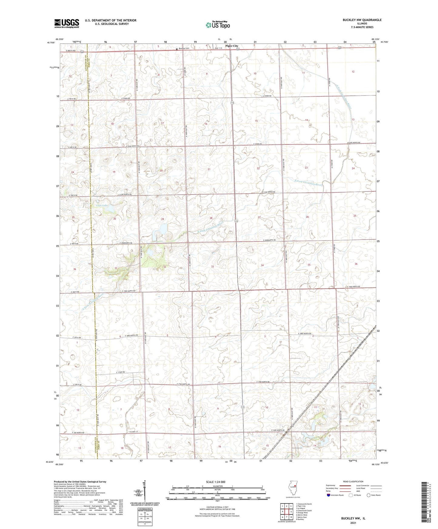
2024 topographic map quadrangle Buckley NW in the state of Illinois. Scale: 1:24000. Based on the newly updated USGS 7.5' US Topo map series, this map is in the following counties: Ford, Livingston, Iroquois. The map contains contour data, water features, and other items you are used to seeing on USGS maps, but also has updated roads and other features. This is the next generation of topographic maps. Printed on high-quality waterproof paper with UV fade-resistant inks.
Quads adjacent to this one:
West: Chatsworth South
Northwest: Chatsworth North
North: Piper City
Northeast: La Hogue
East: Onarga West
Southeast: Buckley
South: Melvin East
Southwest: Melvin West
This map covers the same area as the classic USGS quad with code o40088f2.
Contains the following named places: Beeset Station, Bishop School, Brenton Cemetery, Burger School, Fuoss School, Herr School, John H Garrelts Airport, Lake Shore School, Laue Lake, Laue Lake Dam, Otto Junior Airport, Roberts RLA Airport, Smith School, South Brenton School, Township of Brenton, Township of Lyman, Wagner School, Woodward School, ZIP Code: 60962