MyTopo
La Hogue Illinois US Topo Map
Couldn't load pickup availability
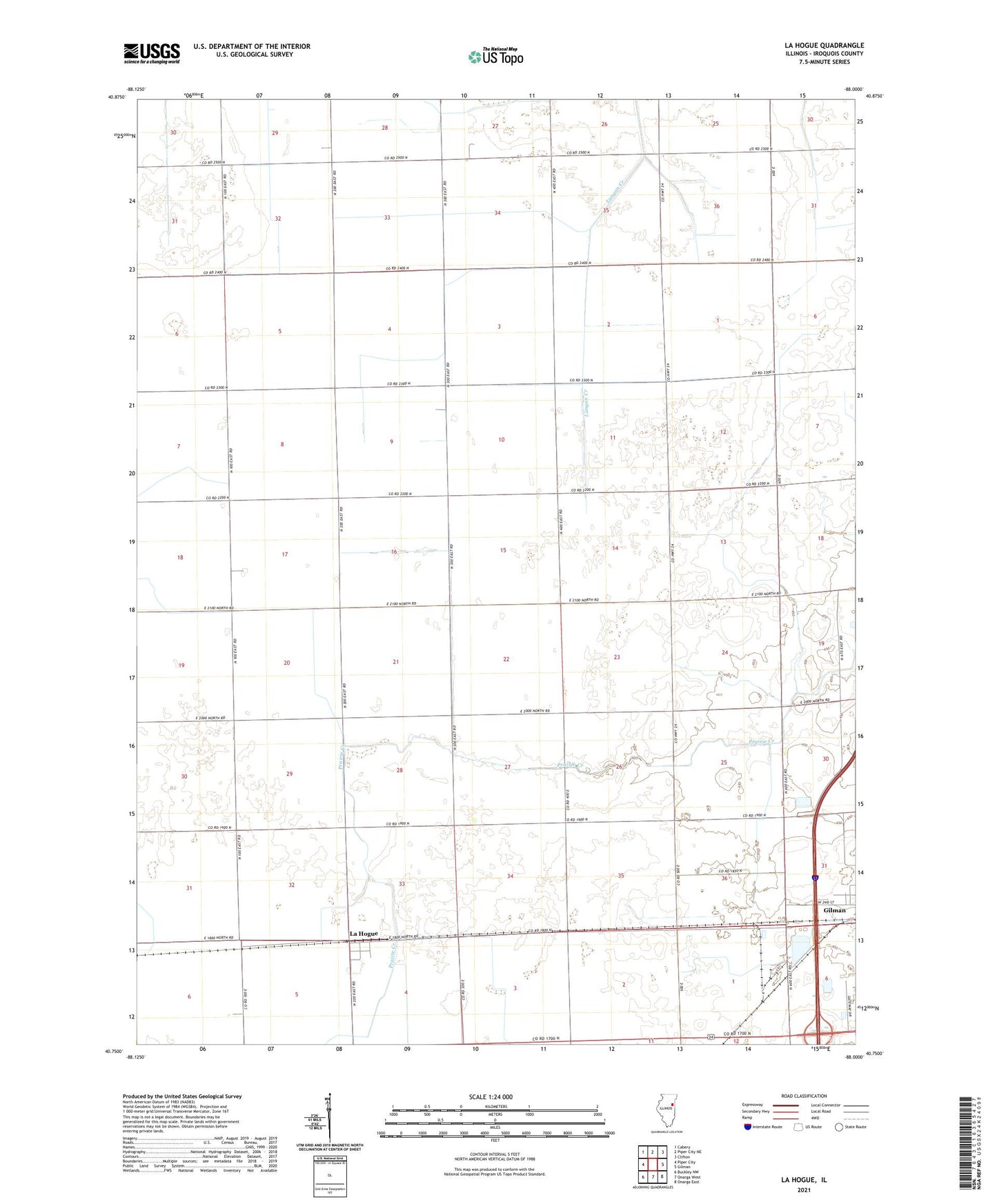
2024 topographic map quadrangle La Hogue in the state of Illinois. Scale: 1:24000. Based on the newly updated USGS 7.5' US Topo map series, this map is in the following counties: Iroquois. The map contains contour data, water features, and other items you are used to seeing on USGS maps, but also has updated roads and other features. This is the next generation of topographic maps. Printed on high-quality waterproof paper with UV fade-resistant inks.
Quads adjacent to this one:
West: Piper City
Northwest: Cabery
North: Piper City NE
Northeast: Clifton
East: Gilman
Southeast: Onarga East
South: Onarga West
Southwest: Buckley NW
This map covers the same area as the classic USGS quad with code o40088g1.
Contains the following named places: Brinkman School, Classen Farms, Classen School, Cleary School, Demoure School, Fraily Farms, Fruin School, Hopewell School, Kafer Farms, Kerns School, Kidd School, Kuiper Landing Strip, La Hogue, Lahogue Post Office, Lee School, Paradise Farms, Perzee Farm, Shule School, Township of Danforth, Township of Douglas, Triple K Single T Farms, Wilken Airport, Zachgo Farm, ZIP Code: 60930