MyTopo
Melvin West Illinois US Topo Map
Couldn't load pickup availability
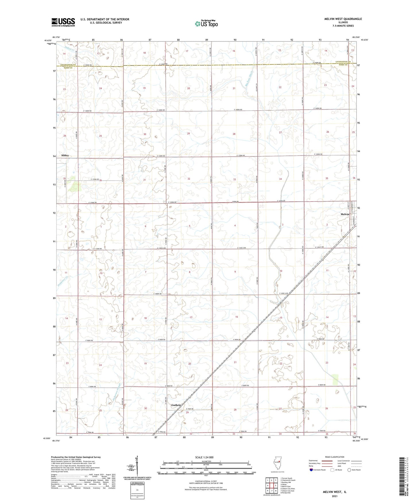
2024 topographic map quadrangle Melvin West in the state of Illinois. Scale: 1:24000. Based on the newly updated USGS 7.5' US Topo map series, this map is in the following counties: Ford, Livingston. The map contains contour data, water features, and other items you are used to seeing on USGS maps, but also has updated roads and other features. This is the next generation of topographic maps. Printed on high-quality waterproof paper with UV fade-resistant inks.
Quads adjacent to this one:
West: Sibley
Northwest: Forrest South
North: Chatsworth South
Northeast: Buckley NW
East: Melvin East
Southeast: Perdueville
South: Gibson City East
Southwest: Gibson City West
This map covers the same area as the classic USGS quad with code o40088e3.
Contains the following named places: Burr Oak Grove, Cothern School, Eclipse School, Grand Prairie School, Guthrie, Guthrie School, Hornstein Farms, Howell School, Miner School, Mueller Farms, Pleasant Valley School, Selock School, Township of Peach Orchard, West Point School, WGCY-FM (Gibson City), ZIP Code: 60952