MyTopo
Burnt Prairie Illinois US Topo Map
Couldn't load pickup availability
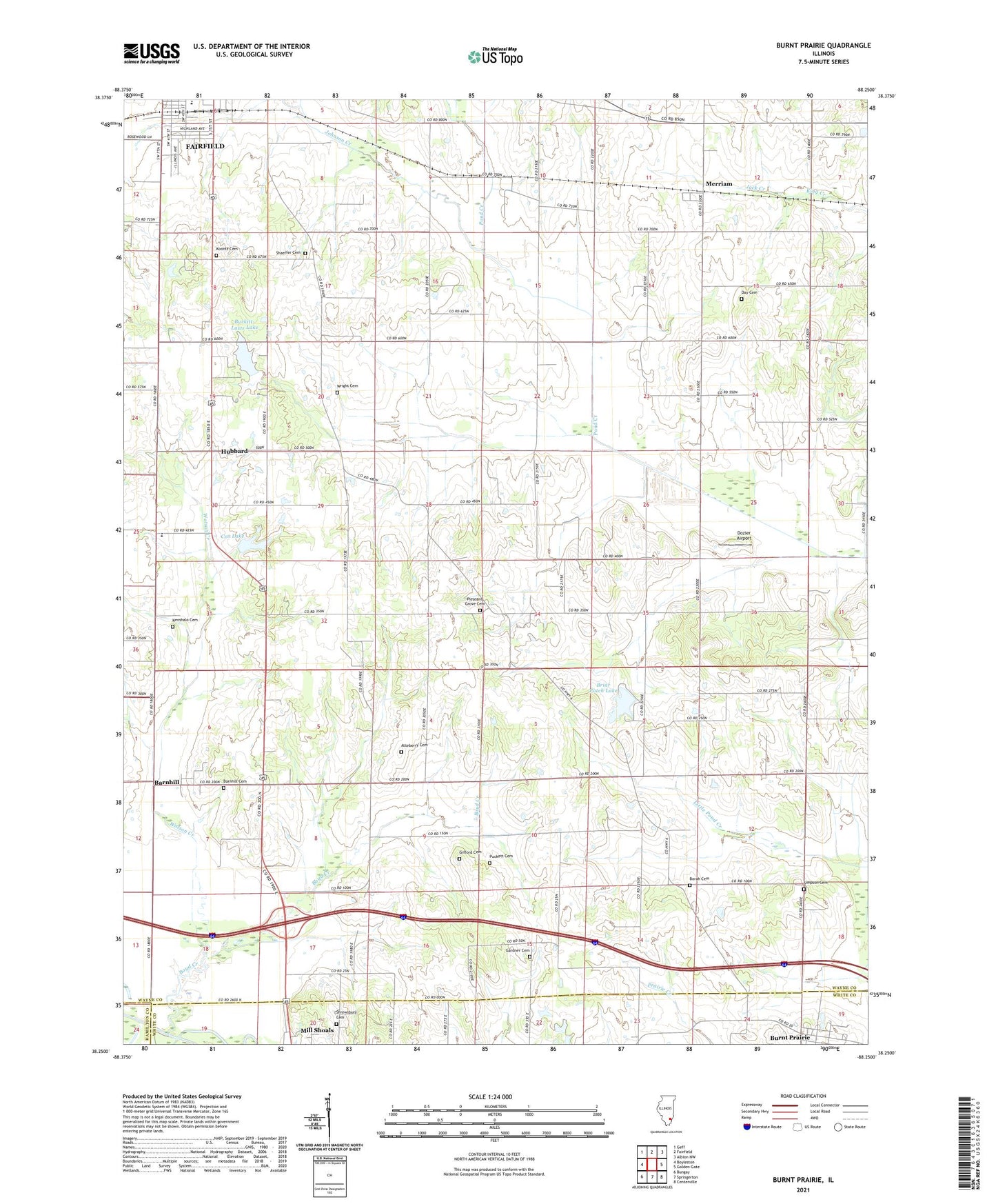
2024 topographic map quadrangle Burnt Prairie in the state of Illinois. Scale: 1:24000. Based on the newly updated USGS 7.5' US Topo map series, this map is in the following counties: Wayne, White, Hamilton. The map contains contour data, water features, and other items you are used to seeing on USGS maps, but also has updated roads and other features. This is the next generation of topographic maps. Printed on high-quality waterproof paper with UV fade-resistant inks.
Quads adjacent to this one:
West: Boyleston
Northwest: Geff
North: Fairfield
Northeast: Albion NW
East: Golden Gate
Southeast: Centerville
South: Springerton
Southwest: Bungay
This map covers the same area as the classic USGS quad with code o38088c3.
Contains the following named places: Atteberry Cemetery, Barnhill, Barnhill Oil Field, Barnhill Townhall, Borah Cemetery, Boyd Creek, Briar Patch Club Lake Dam, Briar Patch Lake, Burkitt-Laws Lake, Burnt Prairie, Carter School, Clay City Oil Field, Cox Lake, Cox Lake Dam, Day Cemetery, Dozier Airport, Fairfield Community High School, Fairview School, First Church of God, Gardner Cemetery, Gifford Cemetery, Hazel Grove School, Holiness Rescue Mission, Hubbard, Jack Creek, Johnson Creek, Johnson School, Kenshalo Cemetery, Klines Corner, Koontz Cemetery, Lebanon Church, Maple Well, Merriam, Merriam School, Moffit School, New Hope Church, New Hope Elementary School, Oakland School, Pleasant Grove Church, Pleasant Ridge School, Pond Creek Drainage Ditch, Puckett Cemetery, Shaeffer Cemetery, Shaeffer School, Shrewsbury Cemetery, Simpson Cemetery, Southwest Park, Sunset Lake, Sunset Lake Dam, Township of Barnhill, Township of Grover, Union Church, Village of Burnt Prairie, Wagner School, Watson Creek, Wayne County Ambulance Service, Wright Cemetery, ZIP Codes: 62809, 62837