MyTopo
Boyleston Illinois US Topo Map
Couldn't load pickup availability
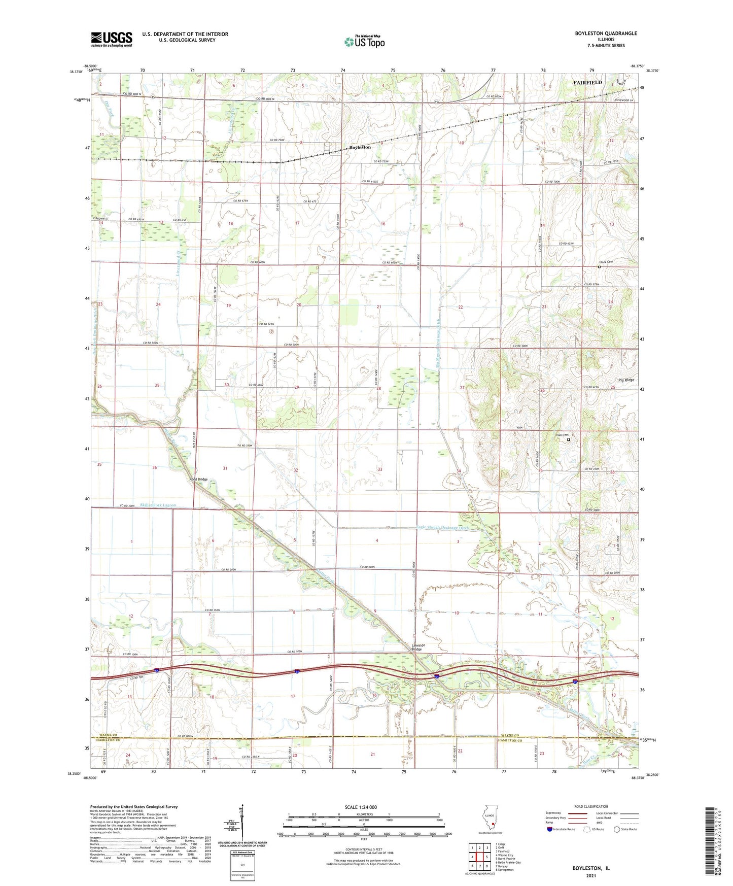
2024 topographic map quadrangle Boyleston in the state of Illinois. Scale: 1:24000. Based on the newly updated USGS 7.5' US Topo map series, this map is in the following counties: Wayne, Hamilton. The map contains contour data, water features, and other items you are used to seeing on USGS maps, but also has updated roads and other features. This is the next generation of topographic maps. Printed on high-quality waterproof paper with UV fade-resistant inks.
Quads adjacent to this one:
West: Wayne City
Northwest: Crisp
North: Geff
Northeast: Fairfield
East: Burnt Prairie
Southeast: Springerton
South: Bungay
Southwest: Belle Prairie City
This map covers the same area as the classic USGS quad with code o38088c4.
Contains the following named places: Aden Oil Field, Big Mound Drainage Ditch, Boyleston, Boyleston School, Campbell, Clark Cemetery, Dry Fork, Dry Fork Drainage Ditch, Eagle Slough Drainage Ditch, Ellis Mound Church, Ellis Mound School, Forest Grove School, Full Gospel Church, Hall Cemetery, Hall School, Haw Creek, Independence School, Lakeside Bridge, Lakeside School, Lebanon School, Little Mound School, Livergood Creek, Lynn Grove School, Oakland School, Pig Ridge, Reed Bridge, Richland Church, Richland School, Shorb School, Skillet Fork Drainage Ditch, Skillet Fork Lagoon, Township of Big Mound, Walton Creek