MyTopo
Bungay Illinois US Topo Map
Couldn't load pickup availability
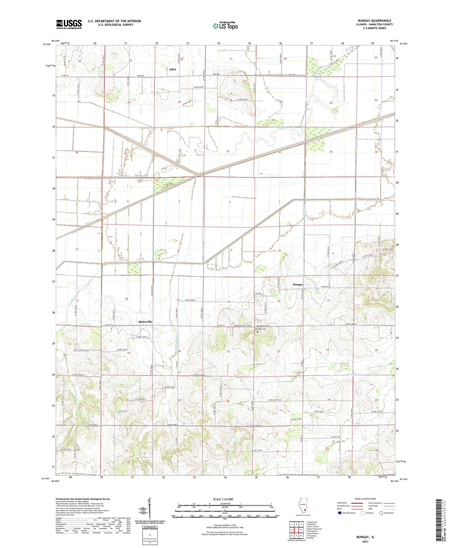
2024 topographic map quadrangle Bungay in the state of Illinois. Scale: 1:24000. Based on the newly updated USGS 7.5' US Topo map series, this map is in the following counties: Hamilton. The map contains contour data, water features, and other items you are used to seeing on USGS maps, but also has updated roads and other features. This is the next generation of topographic maps. Printed on high-quality waterproof paper with UV fade-resistant inks.
Quads adjacent to this one:
West: Belle Prairie City
Northwest: Wayne City
North: Boyleston
Northeast: Burnt Prairie
East: Springerton
Southeast: Enfield
South: Thackeray
Southwest: McLeansboro
This map covers the same area as the classic USGS quad with code o38088b4.
Contains the following named places: Aden, Beaver Creek Church, Beaver Creek Elementary School, Big Creek, Big Creek Drain, Blairsville, Buckskin School, Bungay, Bungay Oil Field, Bunker Hill School, Christian Chapel, Doeskin School, Ferguson Creek, Ferguson Creek Drain, Jefferson City, Lower Aden School, Lower Mill Post Office, Moulton Farms Airport, Mount Pleasant Church, New Hope Church, New London, Pleasant Union Church, Raders Branch, Raders Branch Drain, South Mount Pleasant School, Southern Outlet, Springer Cemetery, Thomas School, Township of Beaver Creek, West Union Church, Wolf Creek, Wolf Creek Drain, York School