MyTopo
Cisne Illinois US Topo Map
Couldn't load pickup availability
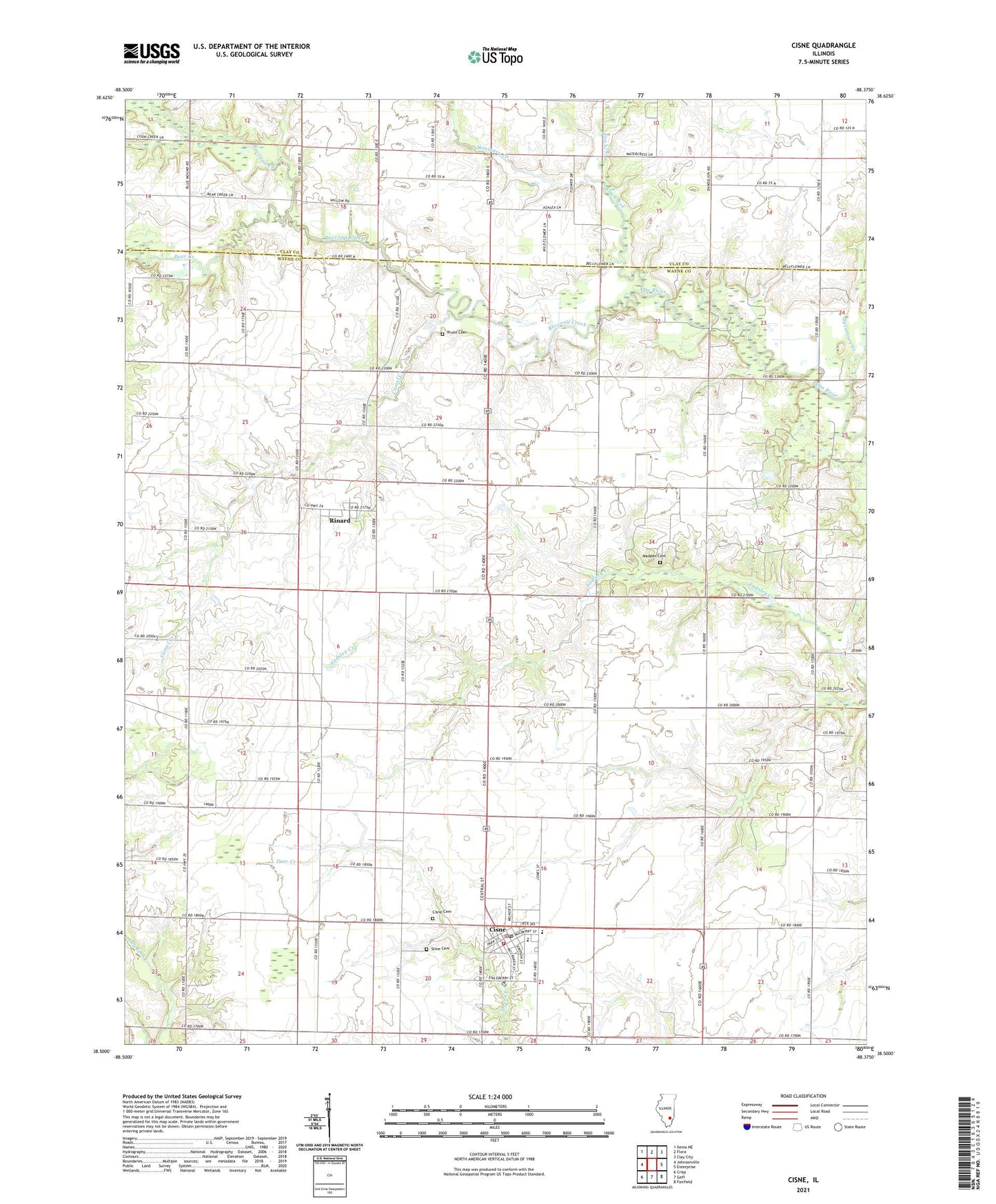
2024 topographic map quadrangle Cisne in the state of Illinois. Scale: 1:24000. Based on the newly updated USGS 7.5' US Topo map series, this map is in the following counties: Wayne, Clay. The map contains contour data, water features, and other items you are used to seeing on USGS maps, but also has updated roads and other features. This is the next generation of topographic maps. Printed on high-quality waterproof paper with UV fade-resistant inks.
Quads adjacent to this one:
West: Johnsonville
Northwest: Xenia NE
North: Flora
Northeast: Clay City
East: Enterprise
Southeast: Fairfield
South: Geff
Southwest: Crisp
This map covers the same area as the classic USGS quad with code o38088e4.
Contains the following named places: Antioch School, Bear Creek, Bedford School, Bedford Township Fire Protection District, Bethel Church, Blue Point, Blue Point Free Will Baptist Church, Blue Point School, Camel Creek, Carthage School, Cisne, Cisne Cemetery, Cisne High School, Cisne Middle School, Cisne Post Office, Elm Creek, Forest Hill School, Gunion Christian Church, Gunion School, Indian Prairie Church, Jordan School, Locust Grove School, Madden Cemetery, North Wayne Ambulance Service, Oak Grove Church, Oak Grove School, Pruitt Cemetery, Raccoon Creek, Rinard, Rinard North Oil Field, Rinard Post Office, Selby School, Seminary Creek, Stine Cemetery, Sycamore Creek, Township of Bedford, Township of Keith, Village of Cisne, Walnut Hill School, ZIP Code: 62823