MyTopo
Crisp Illinois US Topo Map
Couldn't load pickup availability
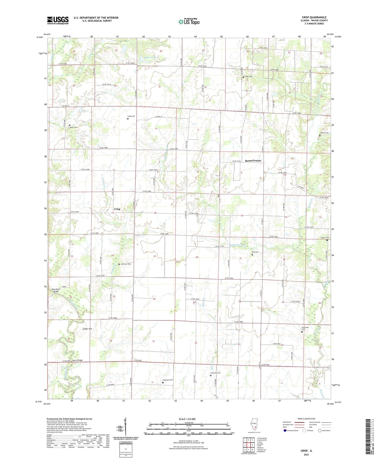
2024 topographic map quadrangle Crisp in the state of Illinois. Scale: 1:24000. Based on the newly updated USGS 7.5' US Topo map series, this map is in the following counties: Wayne. The map contains contour data, water features, and other items you are used to seeing on USGS maps, but also has updated roads and other features. This is the next generation of topographic maps. Printed on high-quality waterproof paper with UV fade-resistant inks.
Quads adjacent to this one:
West: Shields
Northwest: Orchardville
North: Johnsonville
Northeast: Cisne
East: Geff
Southeast: Boyleston
South: Wayne City
Southwest: Bluford
This map covers the same area as the classic USGS quad with code o38088d5.
Contains the following named places: Anderson Cemetery, Anderson School, Arrington Prairie Baptist Church, Bailey Church, Berry Elementary School, Berry School, Berry Townhall, Brown School, Bull Cemetery, Cariens Cemetery, Castor Post Office, Cincinnati, Cincinnati Cemetery, Crisp, Crooked Creek, Forth Cemetery, Hale Cemetery, Harris Bridge, Holloway Cemetery, Hopewell Cemetery, Hopewell Church, Johnson Fork, Johnsonville Oil Field, Johnsonville South Oil Field, Lappin Cemetery, Linder Hill, Little Dry Fork, Logan School, Mabry School, Milner Lake, Milner Lake Dam, New Franklin Post Office, New Liberty School, New Zion Church, Oak Grove School, Pin Oak Church, Pin Oak School, Pleasant Grove Post Office, Pleasant Valley School, Rock Bluff Bridge, Round Prairie, Round Prairie School, Sims Oil Field, South Taylor School, Stinson-Oak Grove Church, Township of Berry, Union Grove Youth Camp, Union Star Church, Wash Branch, Weaver School, Wolfe Cemetery, ZIP Codes: 62850, 62886