MyTopo
Clay City Illinois US Topo Map
Couldn't load pickup availability
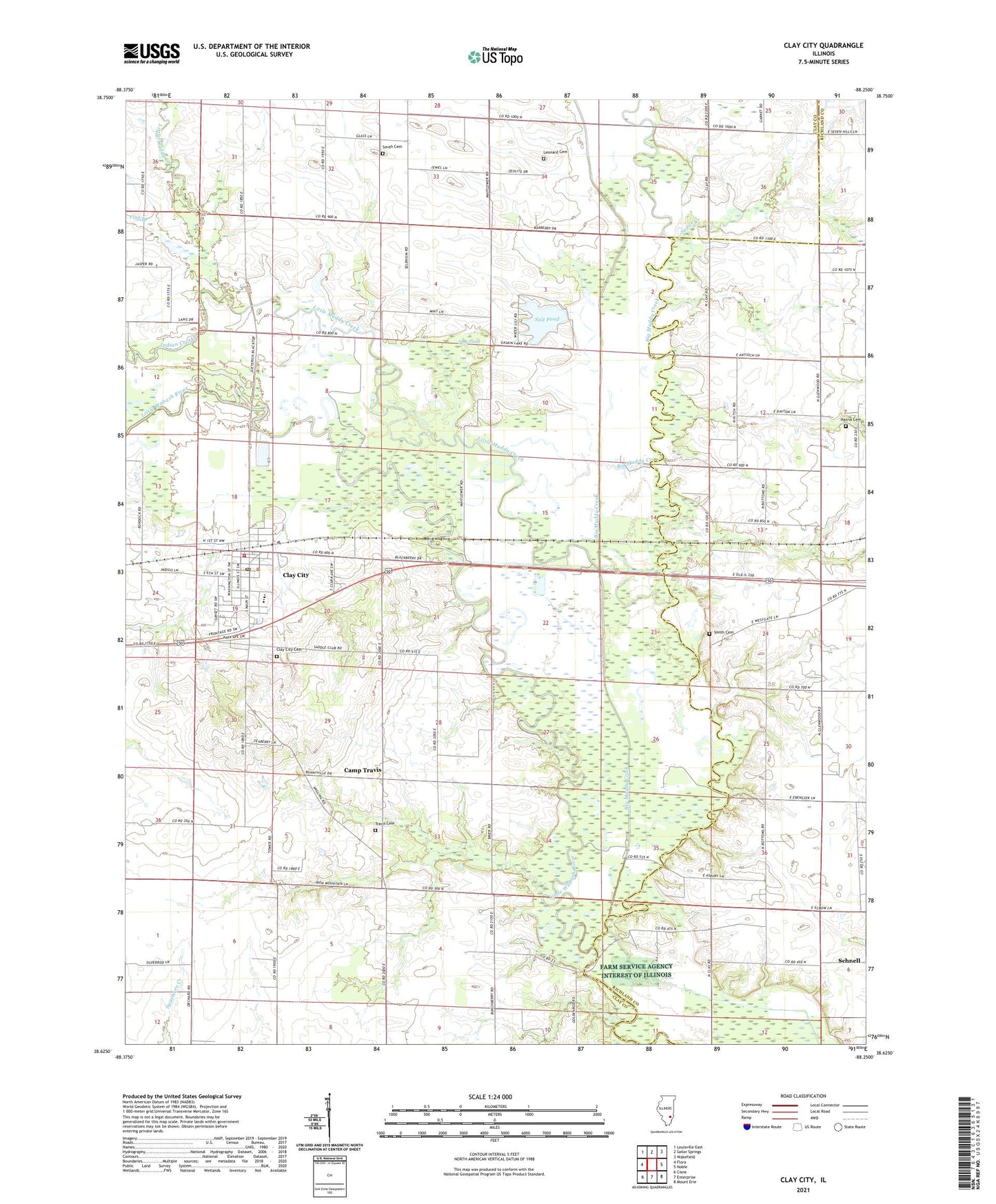
2024 topographic map quadrangle Clay City in the state of Illinois. Scale: 1:24000. Based on the newly updated USGS 7.5' US Topo map series, this map is in the following counties: Clay, Richland. The map contains contour data, water features, and other items you are used to seeing on USGS maps, but also has updated roads and other features. This is the next generation of topographic maps. Printed on high-quality waterproof paper with UV fade-resistant inks.
Quads adjacent to this one:
West: Flora
Northwest: Louisville East
North: Sailor Springs
Northeast: Wakefield
East: Noble
Southeast: Mount Erie
South: Enterprise
Southwest: Cisne
This map covers the same area as the classic USGS quad with code o38088f3.
Contains the following named places: Adventist Church, Big Muddy Creek, Black School, Brushville School, Burcham School, Camp Travis, Clay City, Clay City Cemetery, Clay City Christian Church, Clay City Church of God, Clay City Elementary School, Clay City Fire Protection District, Clay City First Baptist Church, Clay City High School, Clay City Post Office, Clay City United Methodist Church, Flag Pond, Flat Branch, Gaskin Lake, Gaskin Lake Dam, Glenwood, Glenwood Church, Glenwood School, Hanna Cemetery, Indian Creek, Lathrop Chapel, Leonard Cemetery, Little Muddy Creek, Maysville, McKinney School, Pleasant Dale School, Salt Pond, Smith Cemetery, Snyder School, South Freedom Church, Sugar Creek, Township of Clay City, Travis Cemetery, Village of Clay City, Wheeler School, Wilcox Church, ZIP Code: 62824