MyTopo
Cooksville Illinois US Topo Map
Couldn't load pickup availability
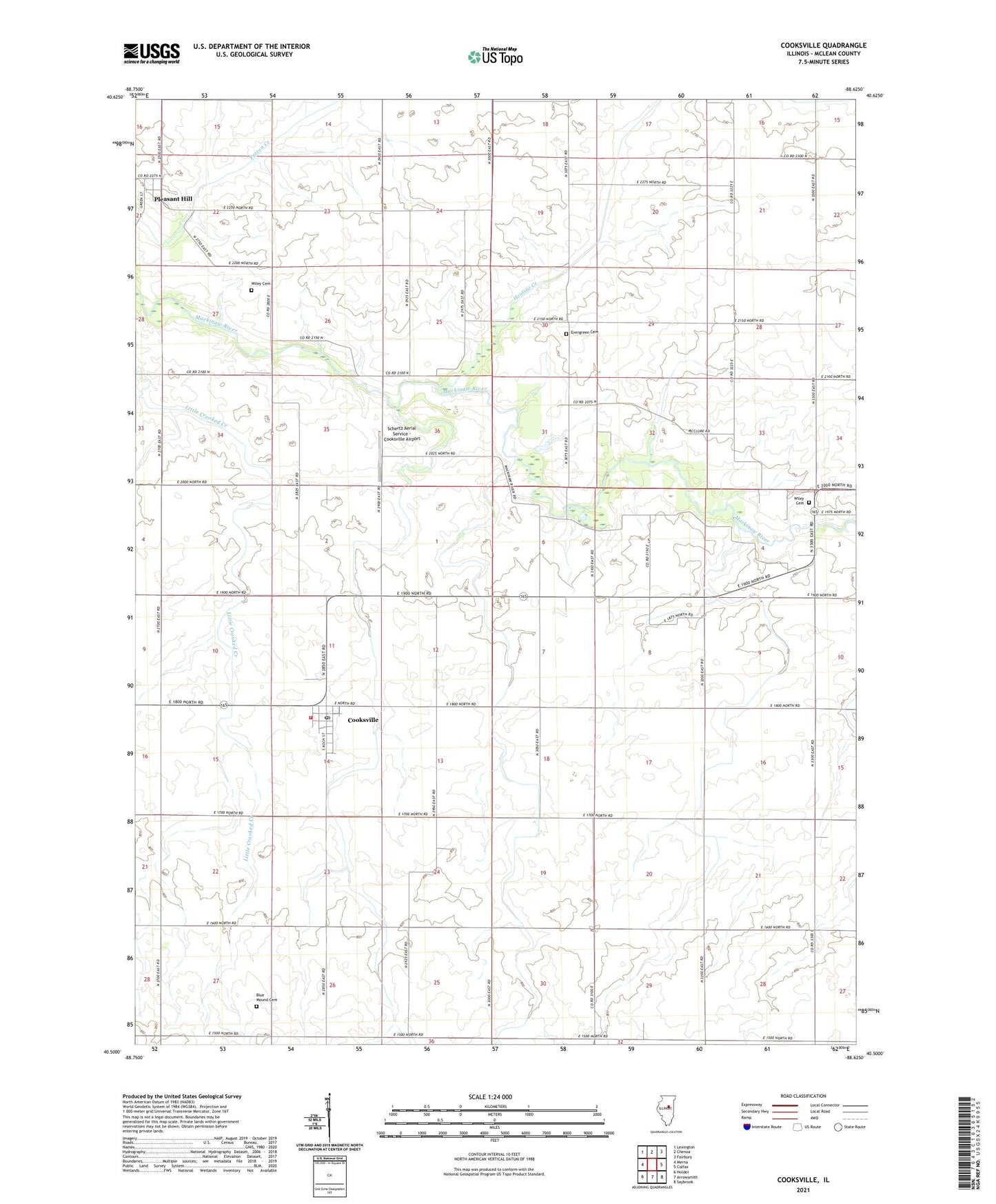
2024 topographic map quadrangle Cooksville in the state of Illinois. Scale: 1:24000. Based on the newly updated USGS 7.5' US Topo map series, this map is in the following counties: McLean. The map contains contour data, water features, and other items you are used to seeing on USGS maps, but also has updated roads and other features. This is the next generation of topographic maps. Printed on high-quality waterproof paper with UV fade-resistant inks.
Quads adjacent to this one:
West: Merna
Northwest: Lexington
North: Chenoa
Northeast: Fairbury
East: Colfax
Southeast: Saybrook
South: Arrowsmith
Southwest: Holder
This map covers the same area as the classic USGS quad with code o40088e6.
Contains the following named places: Blue Mound Cemetery, Cooksville, Cooksville Fire Department, Cooksville Post Office, Evergreen Cemetery, Henline Creek, Pleasant Hill, Schertz Aerial Service - Cooksville Airport, Township of Blue Mound, Township of Lawndale, Township of Lexington, Township of Martin, Village of Cooksville, Wiley Cemetery, ZIP Codes: 61728, 61730