MyTopo
Fairbury Illinois US Topo Map
Couldn't load pickup availability
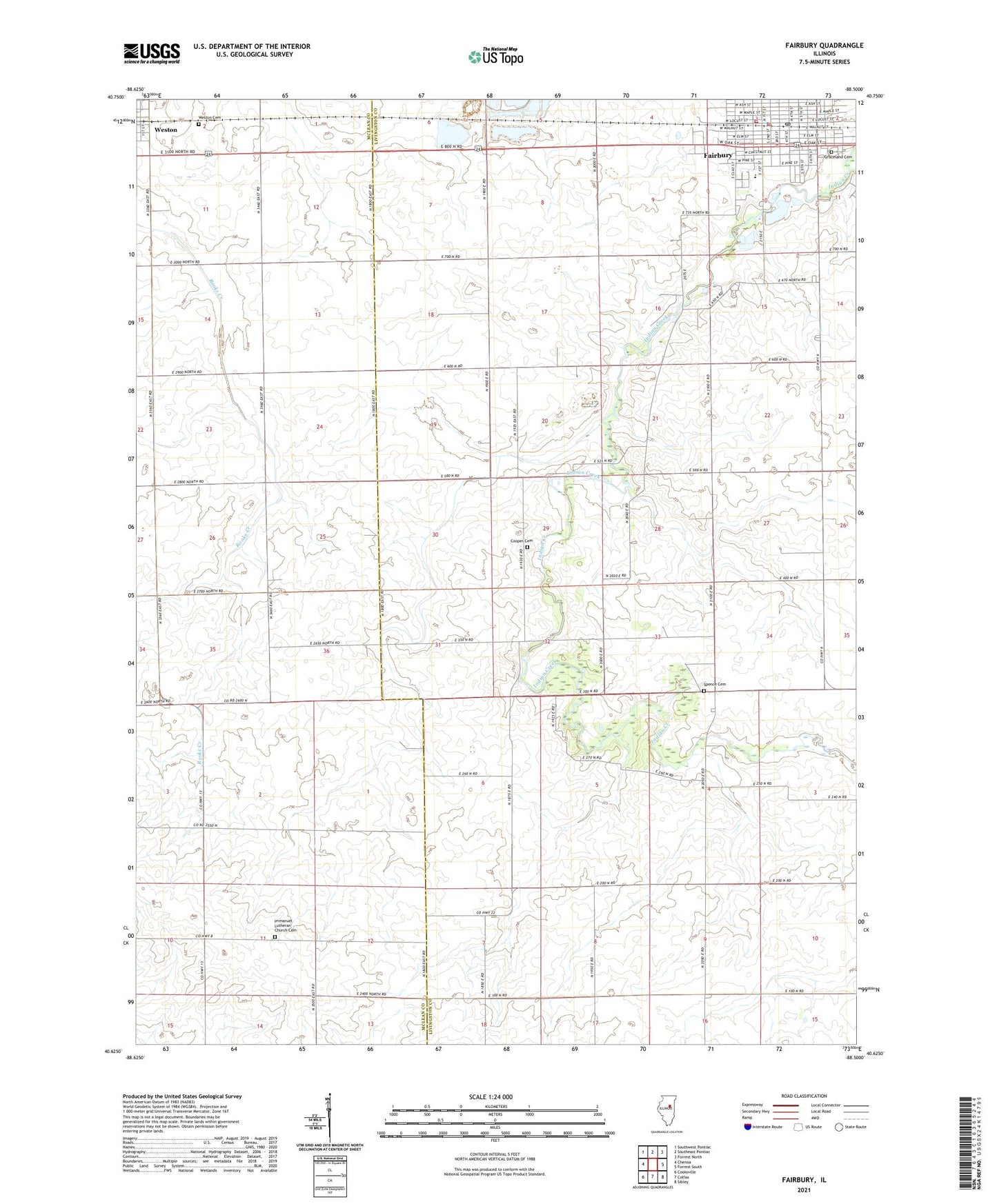
2024 topographic map quadrangle Fairbury in the state of Illinois. Scale: 1:24000. Based on the newly updated USGS 7.5' US Topo map series, this map is in the following counties: Livingston, McLean. The map contains contour data, water features, and other items you are used to seeing on USGS maps, but also has updated roads and other features. This is the next generation of topographic maps. Printed on high-quality waterproof paper with UV fade-resistant inks.
Quads adjacent to this one:
West: Chenoa
Northwest: Southwest Pontiac
North: Southeast Pontiac
Northeast: Forrest North
East: Forrest South
Southeast: Sibley
South: Colfax
Southwest: Cooksville
This map covers the same area as the classic USGS quad with code o40088f5.
Contains the following named places: Christian Apostolic Church, Church of Christ, City of Fairbury, Cooper Cemetery, Dominy Memorial Library, Edison Public School, Fairbury, Fairbury City Hall, Fairbury Fire Department, Fairbury Hospital, Fairbury Hospital Emergency Heliport, Fairbury Police Department, Fairbury Post Office, First Baptist Church, First Presbyterian Church, First United Methodist Church, Free Methodist Church, Gospel Army Church, Graceland Cemetery, Hifer Lake, Hifer Lake Dam, Immanuel Church, Immanuel Lutheran Church Cemetery, Indian Creek Country Club, Isaac Walton Public School, Kilgus Dairy, Livingston Square, Saint Johns Roman Catholic Church, South East Livingston County Ambulance Service, Spence Cemetery, Township of Belle Prairie, Township of Indian Grove, Trinity Evangelical Lutheran Church, Weston, Weston Cemetery, Weston Cemetery Prairie Nature Preserve, Weston Post Office, Westview Elementary School, ZIP Code: 61739