MyTopo
Merna Illinois US Topo Map
Couldn't load pickup availability
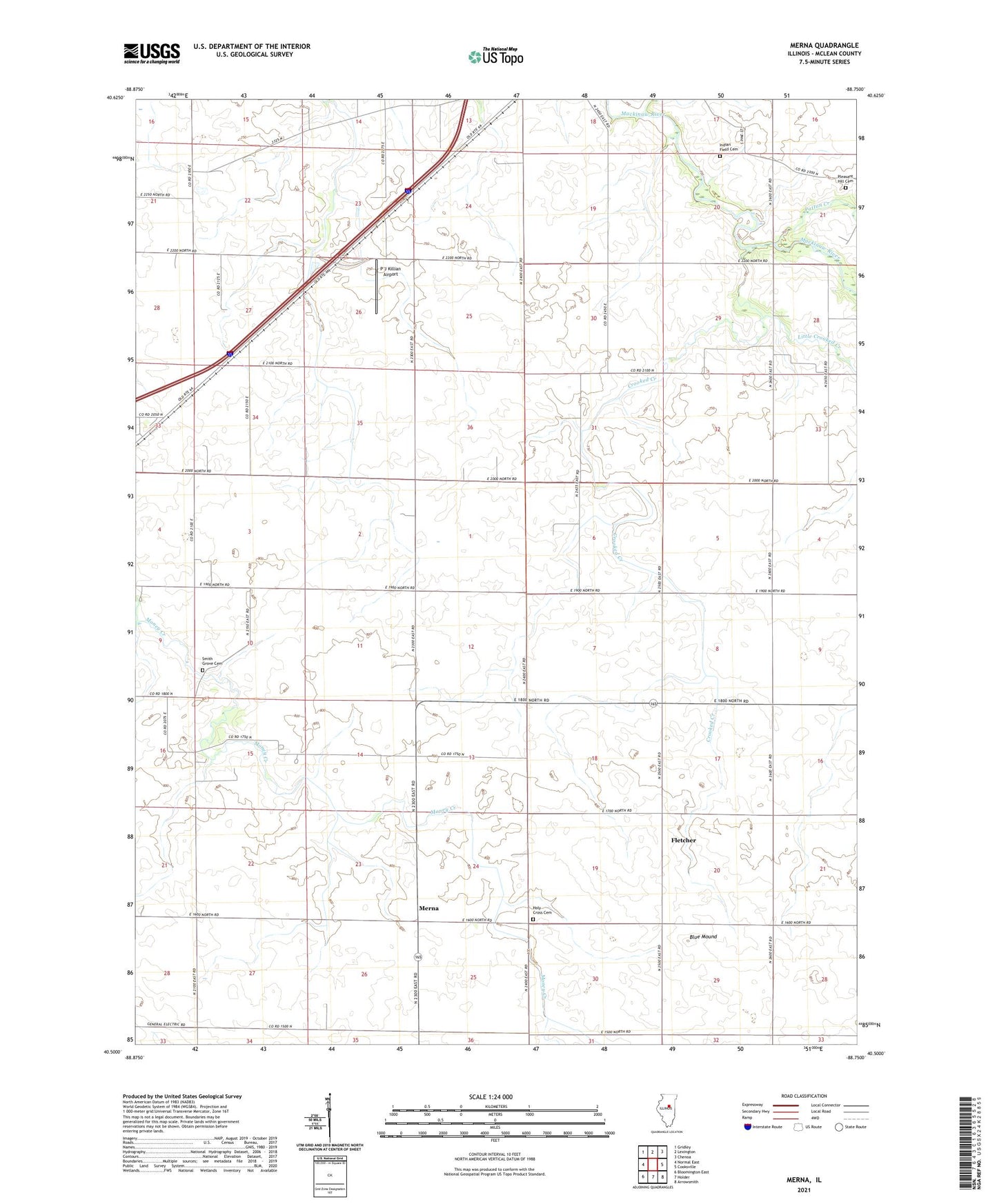
2024 topographic map quadrangle Merna in the state of Illinois. Scale: 1:24000. Based on the newly updated USGS 7.5' US Topo map series, this map is in the following counties: McLean. The map contains contour data, water features, and other items you are used to seeing on USGS maps, but also has updated roads and other features. This is the next generation of topographic maps. Printed on high-quality waterproof paper with UV fade-resistant inks.
Quads adjacent to this one:
West: Normal East
Northwest: Gridley
North: Lexington
Northeast: Chenoa
East: Cooksville
Southeast: Arrowsmith
South: Holder
Southwest: Bloomington East
This map covers the same area as the classic USGS quad with code o40088e7.
Contains the following named places: Ballard School, Blue Mound, Chandler School, Crooked Creek, Fletcher, Frog Alley School, Holy Cross Cemetery, Horney School, Indian Field Cemetery, Lincoln School, Little Crooked Creek, Merna, Merna School, P J Killian Airport, Patton Creek, Phoenix School, Pleasant Hill Cemetery, Popejoy School, Schlosser Airport, Smith Grove Cemetery, Snow RLA Airport, Township of Money Creek, Township of Towanda, Union School, ZIP Code: 61776