MyTopo
Doddsville Illinois US Topo Map
Couldn't load pickup availability
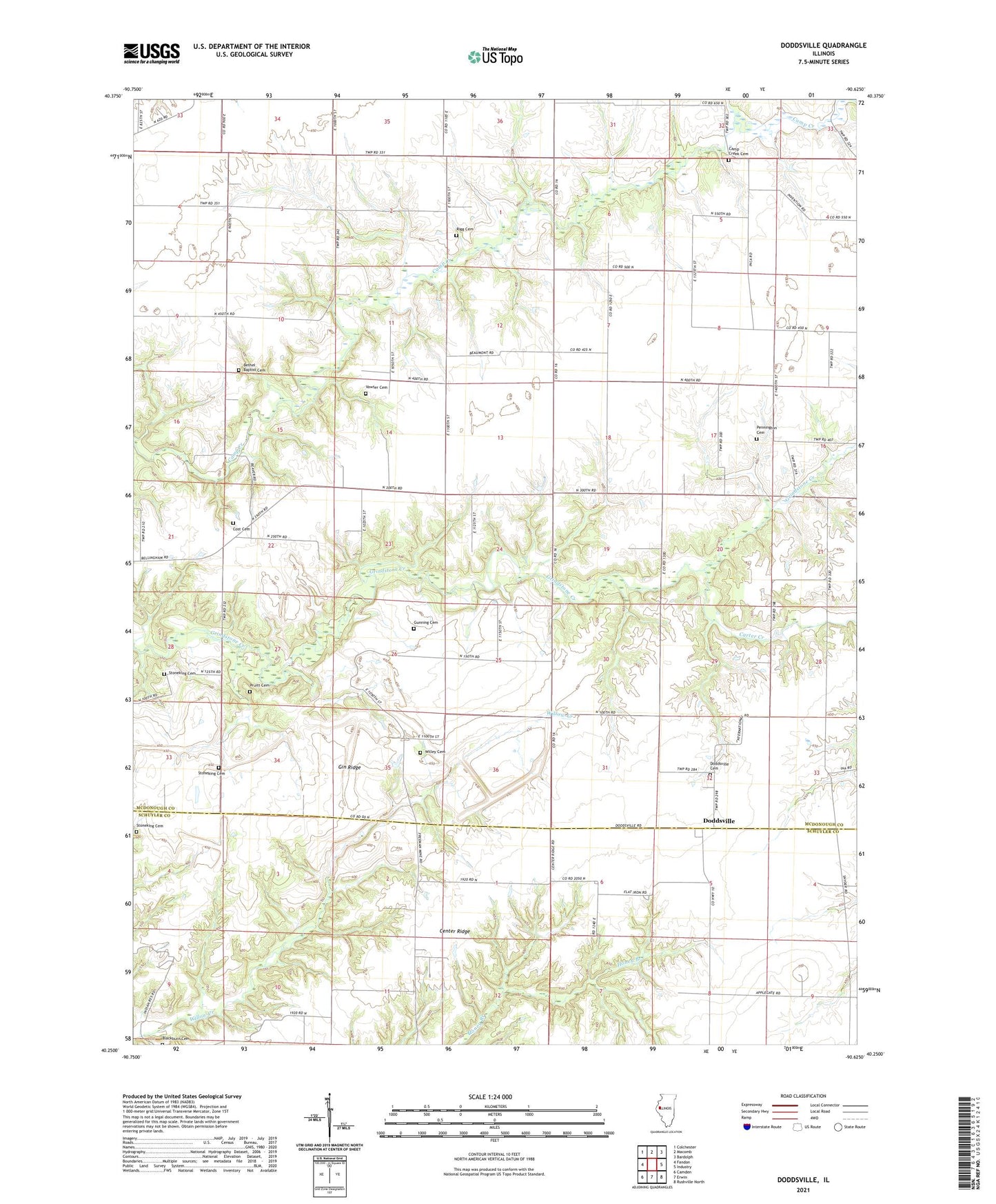
2024 topographic map quadrangle Doddsville in the state of Illinois. Scale: 1:24000. Based on the newly updated USGS 7.5' US Topo map series, this map is in the following counties: McDonough, Schuyler. The map contains contour data, water features, and other items you are used to seeing on USGS maps, but also has updated roads and other features. This is the next generation of topographic maps. Printed on high-quality waterproof paper with UV fade-resistant inks.
Quads adjacent to this one:
West: Fandon
Northwest: Colchester
North: Macomb
Northeast: Bardolph
East: Industry
Southeast: Rushville North
South: Erwin
Southwest: Camden
This map covers the same area as the classic USGS quad with code o40090c6.
Contains the following named places: Bethel Baptist Cemetery, Blackburn Cemetery, Blazer School, Bowman Cemetery, Camp Creek Cemetery, Carter Creek, Center Ridge, Coker School, Cost Cemetery, Cottage Corner School, Doddsville, Doddsville Cemetery, Doddsville Community Methodist Church, Doddsville Presbyterian Church, East Bethel Methodist Church, East Bethel School, Flatiron School, Gin Ridge, Gunning Cemetery, Hickory Grove Corner, Lower Center School, Mount Zion Free Methodist Church, Mount Zion School, New Era School, Pennington Cemetery, Pruitt Cemetery, Rigg Cemetery, Runkle School, Siesta Post Office, Snyder School, Stoneking Cemetery, The Thousand Acres, Township of Bethel, Union Church, Upper Center School, Vawter Cemetery, Victor School, Willey Cemetery