MyTopo
Bardolph Illinois US Topo Map
Couldn't load pickup availability
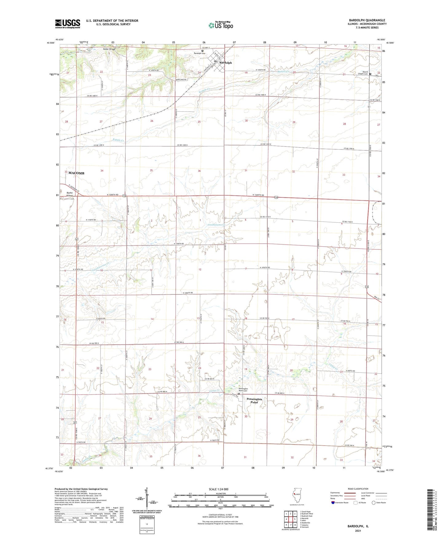
2024 topographic map quadrangle Bardolph in the state of Illinois. Scale: 1:24000. Based on the newly updated USGS 7.5' US Topo map series, this map is in the following counties: McDonough. The map contains contour data, water features, and other items you are used to seeing on USGS maps, but also has updated roads and other features. This is the next generation of topographic maps. Printed on high-quality waterproof paper with UV fade-resistant inks.
Quads adjacent to this one:
West: Macomb
Northwest: Good Hope
North: Bushnell West
Northeast: Bushnell East
East: Adair
Southeast: Vermont
South: Industry
Southwest: Doddsville
This map covers the same area as the classic USGS quad with code o40090d5.
Contains the following named places: Bardolph, Bardolph Cemetery, Bardolph Cumberland Presbyterian Church, Bardolph High School, Bardolph Post Office, Bardolph Presbyterian Church, Bardolph United Methodist Church, Blythe Airport, Camp Creek School, Center Point School, Cottonwood Baptist Church, Cottonwood School, Crown Point School, Fairview School, Frogpond School, Hanson School, Holler Bridge, Jackson School, Jones School, Maple Grove School, Mound Chapel Cemetery, Mound Chapel Methodist Church, Mound Townhall, New Salem Christian Church, Palmer Airport, Pennington Point, Pennington Point Cemetery, Pennington Point Methodist Church, Pennington Point School, Pleasant Grove School, School Number 16, School Number 84, Scotland Townhall, Scotland Trinity Presbyterian Church, Township of Mound, Township of New Salem, Township of Scotland, Union Church, Union School, Village of Bardolph, Wetzel School, Wiley School, Yokum School, ZIP Codes: 61411, 61416